Friday, August 14, 2015

Chapter 41 - Shell Lake to Mackinaw City, Michigan

Monday, August 10th:
We left Shell Lake and our friends Lee and Dotty Swan about 8 am with a plan to drive around 4-1/2 hours and spend one night only at the Summer Breeze Campground near Iron Mountain, Michigan.  Iron Mountain which is near the Wisconsin Michigan stateline is approximately half the distance between Shell Lake and Mackinaw City. While Minnesota claims the credit for being the Land O'Lakes, northern Wisconsin has its plentiful share of lakes as well. Our drive across Wisconsin allowed us to view many log cabins and cottages on numerous small picturesque lakes that at times reminded us of both our cottage on Seneca Lake in New York's Finger Lakes Region as well as our own log cabin in Blue Ridge, Georgia.  It was an easy drive on a two lane road but with frequent passing lanes.  We passed through numerous small towns many only two blocks long containing a small bar, a restaurant, a grocery store, a gas station, a church, and then quickly the speed limit returned to  55 mph. Iron Mountain was a nothing special city of 7,700 residents. It was at one time a mining town due to nearby iron ore deposits, but that resource has been depleted and since the 1930s the town's population has been gradually diminishing.  Once setup in our campground, we drove into Iron Mountain, did a little shopping, did not take any photos, and then retuned to our campground. We had no internet service at our campsite nor did we enjoy cable TV coverage.  We both read a little and went to sleep early. On the positive side, our campsite was well shaded and private (no immediate neighbors) and the night time temperatures were in the mid-50s; we slept well.

Tuesday, August 11th:  
We knew this morning that after a short drive we would be passing into the Eastern Time Zone and we would be officially "back east" at least in a manner of speaking.  Since we had gone to bed a little earlier than usual we decided to leave by 7:00 am which of course would quickly change to one hour later when we crossed the time zone. Funny how our electronic devices like our telephones, iPads, and our Garmin all automatically adjust for time zone changes but not my brand new cheap Walmart wrist watch nor the clock in our modern car. Despite the loss of one hour of our day we had a very pleasant drive over to the Straits of Mackinac especially when our highway passed along the north shores of Lake Michigan.  The photo above was taken just before our arrival at the Mackinac Bridge where I-75 crosses through the Straits of Mackinac at the connecting point of Lake Michigan and Lake Huron.

The bridge cost us $6.00 to cross; we are now official taxpayers in the State of Michigan. We were a little nervous as we started up the bridge as a sign at the toll booth warned of the high winds passing down thru the strait.  I guess we must be used to our car swaying as we pull our trailer since if the winds were causing the bridge to sway, we did not even notice it.  The Mackinac Bridge was kind of neat to cross.  It is 26,372 feet long and rises to 200 feet over the water below.  According to a website that we read, the bridge can sway up to 35 feet east and west in high winds. Wow, hard to believe that we would not notice a sway of that magnitude.
The Mackinac Bridge is the fifth longest suspension bridge in the world and the longest in the western hemisphere.  And we crossed it.

After crossing the bridge we exited immediately into Mackinaw City, a tourist town like we have rarely seen with hotels and tourist shops everywhere. We then continued down the coastline of Lake Huron for a couple of miles before arriving at our new home for the next two nights, Mackinaw Mill Creek Camping.  Our campground lay right on the shoreline of Lake Huron and we could hardly believe our luck when we realized that we had landed a full hookup site that had an almost direct view of the water and in the distance, the Mackinac Bridge that we had crossed only minutes earlier. This campground is by far the largest we have stayed with over 600 sites with 200 of them being full hookup.  Furthermore the campground was close to capacity which meant that the residents here in Mackinaw Mill Creek Camping outnumbered the roughly 900 full time residents of the nearby Mackinaw City.

Not surprisingly with all of the campsites and visitors we found that the WiFi in the park was worthless except right at the general store and even there it was slow. Furthermore despite the size and scope of the campground they have yet to make available a cable TV hookup.  I guess we should not be surprised as we are sure that the vast majority of visitors here want to get out and spend the day visiting the attractions.  What is on TV or on the internet can wait until they return home.  After getting our travel trailer all hooked up and taking a long walk along their grass covered "beach" area which was actually more like a city park complete with benches, we decided to again drive downtown, check out their Main Street, and stop at the local grocery store for a few supplies. We returned by five o'clock and spent the rest of the evening sitting under our "front porch" awning area enjoying the setting.


Wednesday, August 12th:
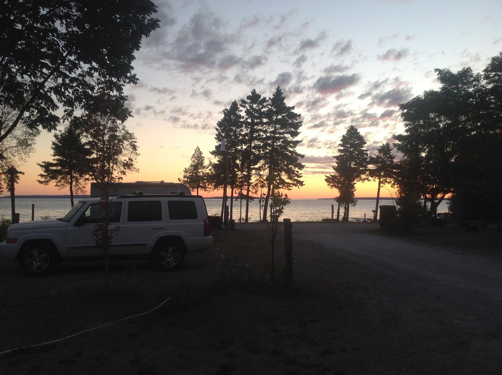
This morning I jumped in our car at around 5:30 am hoping to be able to upload today's addition of the Wall Street Journal over at the campground store. Despite our long cross county journey, I still love to read the Journal every morning over a cup or two of hot coffee.  Old habits do not die. As I started up the car for the two minute drive over to the store, I had to stop the car right in front of our trailer for the sunrise was much to beautiful not to record "on film" (so to speak).  This was the same view that I had seen a few minutes earlier just before climbing out of bed. The view of the sunrise in person was so much better than this photo has captured.

After a few cups of coffee, a great egg and Wisconsin cheese breakfast prepared by Kathy, and a 6 gallon hot water shower in our 18" x 24"' tub in our trailer, Kathy, Cabo, and I headed for metro Mackinaw City around 8:00 am for an early start to sightseeing before the rest of the crowds.  Naturally most everything was closed until 9:00 am so we drove around checking everything out before stopping in a park nearby the Mackinac Bridge and I took this photo of Kathy spying on drivers on the bridge.  Today the wind was calm and the sun was shinning.


On the way to the museum and gift store located directly under the bridge we walked by the Old Mackinac Point Lighthouse that was constructed in 1889 and operated until 1957 when the construction of the bridge was completed and the lighthouse was no longer needed.  The building is now on the National Register of Historic Places and it is opened to the public for a small fee.  We enjoyed looking at the exterior for free and reading the history of the lighthouse on the historical marker in front of the building.


Our next stop was at a small museum and gift store which was the welcome center for a recreated old fort that was named Fort Michilimackinac.  The original fort was built by the French around 1715, and later taken over by the British but was ultimately abandoned in 1783.  While Cabo was allowed into both the museum as well as into the recreated fort, we elected not to visit the fort both because the admission fee was rather expensive but more importantly, because the fort was not real.  For those of us who have visited numerous authentic forts like Fort Niagara in Youngstown, New York which consists largely of the original buildings constructed during a similar time period as the original Fort Michilimackinac, visiting a make-believe fort for an $11 fee each just did not seem to be worth the time nor the money. We enjoyed the museum and Kathy enjoyed their gift shop.

In keeping with our quest to find historic buildings in this mostly new tourist oriented city we decided to drive a few miles southwest of the city to visit another old lighthouse, the McGulpin Point Lighthouse.  Construction of this lighthouse began in 1868 and it remained in operation until it was rendered obsolete when the Mackinac Point Lighthouse was placed in operation around 1890. I did have a chance to climb up into the lighthouse banging my head on part of the winding steel stairs as I climbed only to discover that many of the surrounding trees blocked part of the view of the otherwise magnificent scene of Lake Michigan and its far off northern shores.  The interior was beautifully restored and furnished with period appropriate furniture. 

We spent the rest of the morning walking through the downtown streets of Mackinaw City. It is almost unreal that almost nothing in Mackinaw looks more than a few years old including the dozens of hotels, the many stores, and even the homes.  It is as if the tourists of Michigan suddenly discovered the area and Walt Disney stepped in and built everything overnight. I am obviously exaggerating although the construction of the bridge in the late 1950s was undoubtedly the impetus that drove the hordes of tourists to this scenic area. While Kathy loved the many stores downtown, I must admit I far prefer the older and more historic towns we have visited during the past few months. As you might see in the above photo of Kathy looking into the windows of the Trails End General Store, Mackinaw did a reasonably good job of making their stores look like they might have been built 100 years ago.

We returned to our campground in the early afternoon for lunch followed by an afternoon of relaxation. Kathy is reading a new book, The Oregon Trail written by Rinker Buck, which she read for several hours while sitting in a gazebo out by the shoreline of Lake Huron.  This has to be one of the best parts of traveling.  

Tomorrow we are heading due south for the first time since our trip began back in late May. We have enjoyed traveling in the northern states not only because it is an entirely new experience for Kathy but also because both of us are enjoying the mostly cool weather.  It is really great not to have to use our noisy air conditioner.  Kathy actually selected our next campground located in Frankenmuth, Michigan.  Neither of us have ever heard of Frankenmuth but we have heard of the highly rated franchised Jellystone Park campgrounds so having a nice home site for the next two nights is good enough for us.

Monday, August 10, 2015

Chapter 40 - St Paul to Shell Lake, Wisconsin

Saturday, August 8th:
The drive this morning had most of the features we love: it was short, the roads were out in the countryside and the traffic was light, and the scenery was pretty with lots of trees, rolling hills, and the many cornfields we have come to expect. Since there is no direct highway that leads to Shell Lake from St Paul we made lots of turns and highway changes and were it not for the excellent assistance of our Garmin, I am sure that we would have gotten lost.  But we did not, and by 10:30 am we pulled into the Red Barn Campground and we were immediately greeted by our friend Dotty Swan.  After a few hugs and a brief discussion we were shown to our pull-thru, full hookup campsite which without question was one of the loveliest campsites that we have been offered since our adventure began on May 26th.

The land upon which sits the Red Barn Campground has been in Lee Swan's family since his grandparents purchased the land back in 1917 and soon after began operating it as a dairy farm.  In 1965 they opened a small tenting campground which has obviously grown substantially ever since with this year marking the 50th anniversary of the Red Barn Campground.  The name of the campground Red Barn, is well suited as the beautifully restored red barn that sits right in the middle of the campground is perhaps the focal point of the entire site.

One other very unique feature of this campground that distinguishes it from almost all other campgrounds in our country is that there are live farm animals on the site including horses, sheep, chickens, rabbits, and even two llamas. Visitors to the campground are allowed to interact with the animals which obviously makes this campground very popular with young folks. Horseback riding is offered and in fact when we first arrived we could see Lee Swan back in the park walking along side a small horse with a small rider on its back.  Wagon rides are offered most days pulled by a tractor during the week and pulled by live horses on weekends. Inside the barn on the upper level is a large activity room that offers lots of indoor games and according to Lee Swan he has even setup his own pickleball court (inspired he admits by Breckenridge's efforts to build pickleball courts.) They also have on site a miniature golf course that Lee constructed and his wife Dotty landscaped.  Their little course is as nice as any miniature golf course that I have ever seen.

In the early afternoon Lee called me over to watch he and his son harness up two horses in preparation for their Saturday afternoon wagon ride.  Lee first groomed each of the two female horses who were named Mollie and Millie.  They were stepsisters he told me; same father different mothers.  Then he and his son placed the very elaborate harnesses on each of the two horses which was not an easy task, and then we walked the girls, Mollie and Millie, over to the wagon and hitched them up for the ride. 


Kathy and I and Cabo climbed aboard the wagon and went for a most delightful one hour ride around the property including going over to nearby Shell Lake where Lee and Dotty own a "cottage" where we picked up some of their grandchildren and a son-in-law, and then back into the property where we took a long ride back into some of their 100 plus acres that used to be grazing land.  It was a wonderful experience for us old folks and for the young kids as well.  A unique experience especially to find at a campground. It was hard to know whether Cabo enjoyed the ride although not once did he complain.

After our ride in the wagon, we returned to our travel trailer where we relaxed for a few hours before Dotty Swan invited us back to her house for some peach cobblers with ice cream. After we arrived at their summer home located at the entrance to their campground, we were given a tour of their miniature golf course next to their home and their chicken and rabbit enclosures. We really need to hand it to Lee and Dotty who while in the late seventies still have the strength and ambition to operate such a well managed facility.  It sure takes a lot more ambition than I could muster and I am five years younger than Lee and Dotty.

Sunday, August 9th:
Today is to be a day of total relaxation as we have no local tourist attractions to visit, no spectacular cathedrals, and no high mountain vistas or deep gorges to view.  Other than a short visit to downtown Shell Lake which should take very little of our time, today is a day where we have nothing planned and it is wonderful.  I even delayed taking my shower and getting dressed until after 8 am this morning and that is a personal record for goofing off.  Even Cabo was happy since today he was mostly exempt from long car rides which he hates and he was free to walk around the campground without a leash, at least within reason.  Obey my rules and no leash! OK Mom.

Since we had nothing planned today I was actually pleased when at one-thirty this afternoon it started to rain. This gave us the opportunity for the first time since we have owned our travel trailer to sit outside under our awning listening to the rain as it hit the awning, talk occasionally, and continue reading our books without a guilty feeling about missing out on a visit to some great tourist attractions. Both of us are reading mystery novels by David Baldacci. Such a delightful outdoor afternoon would not be available in Florida with its high heat and humidity but here in Shell Lake the temperatures are only in the high 60s and the humidity is low even with the rain.  Across from us was another travel trailer and we watched them with a smile as their whole family consisting of three adults and three young children sat at their picnic table under their awning eating lunch. Like us, it did not seem to bother them one bit that it was raining.

We were pleasantly surprised once again by Lee and Dotty Swan when they invited us out for dinner this evening. We quickly accepted. The food at the Country Inn Restaurant was very good and we enjoyed the opportunity during dinner to spend this extra time with our campground hosts and most importantly, with our friends. When we returned back to our travel trailer after dinner Kathy commented that she was really happy that we had decided to spend two nights of our trip at the Red Barn Campground.  It was not only one of the nicest campgrounds of our trip, but the campground hosts were definitely the very best. Almost hate to leave.      

But tomorrow we will leave early for the Summer Breeze Campground and RV Park located on the western border of the State of Michigan near the City of Iron Mountain. We are headed for the Straits of Mackinac. 

Sunday, August 9, 2015

Chapter 39 - Jackson to St. Pauls, Minnesota

Thursday, August 6th:
The drive from Jackson to our campsite east of St. Paul, Minnesota was relatively easy as it was entirely on interstate highways. That said, after 4-1/2 hours both Kathy and I were still tired of driving.  Perhaps our age and 2-1/2 months on the road was starting to show.  Part of the problem as we neared the Minneapolis and St Paul area was that the traffic started to increase as did the amount of road construction which in most cases restricted the traffic down to a single lane in each direction.  Since I was accustomed to driving no more than 55 mph on the interstates and letting EVERONE pass us, the single lane restriction suddenly forced me to increase our speed to at least 60 mph to prevent a huge buildup of cars behind us. Fortunately when we arrived at the St. Paul East Campground we were pleasantly surprised with the attractiveness of our new home which almost immediately reduced our stress levels caused by the drive. We should be used to driving pulling a 1-3/4 ton trailer behind our car but even after almost 2-1/2 months such is not the case.  Our trailer site was shaded and comfortable - the perfect setting.

Unfortunately the weather here in St Paul was projected to be wet and perhaps windy. This we learned from the local TV channels via our antenna. With no cable TV coverage Kathy was the first to point out that if we wanted to watch the Republican debates on FOX news tonight, we were out of luck. Who knows, perhaps we were lucky. Despite the potentially rainy weather Kathy and I both agreed that we wanted to drive to downtown St. Paul to visit their famous Cathedral of Saint Paul. The drive was only about ten miles mostly on I-94 and we figured that we could be there in around 20 minutes.  Naturally with all of the traffic and the construction we ended up in a wrong lane then after driving hither and fro in all directions we finally, possibly after some divine guidance, pulled up alongside the church about 45 minutes later.

The photograph of the cathedral that shows above I actually took on Friday morning for after being at the church today for about 30 minutes mostly spent inside, it started to rain and the photos that I did take of the exterior were pretty depressing considering the overcast skies. Such a magnificent structure well deserves to be shrouded in sunshine. As this photo to the left shows the inside of the Cathedral of Saint Paul is truly beautiful. Kathy and I have visited many famous and elegant churches during our past travels including St. Peter's Basilica at the Vatican in Rome and Westminster Abbey in London among others, and the Cathedral of Saint Paul is equally impressive and for us an unexpected surprise.  We both enjoy visiting old historic structures and particularly old churches but we never thought we would find such a building in St. Paul, Minnesota.  We returned to our campground by mid-afternoon and because of the rather gloomy weather we remained mostly inside relaxing in our travel trailer.


Friday, August 7th:
Our plan today was to again visit the Cathedral of St. Paul then drive down a street named Summit Avenue near the church where there are suppose to be a lot of old and very large and beautiful homes. After that if we still wanted to continue driving, we will go into Minneapolis and visit another old Catholic Church, the Basilica of St Mary. Incidentally, one of the reasons that we favor going to the old Catholic churches is that they are most always open to the public. Our second visit to the Cathedral of St Paul had another purpose besides my taking a better photograph.  Yesterday during our visit there was a funeral in progress and as a result their gift store was temporarily closed.  Enough said in that regard.  However today, Kathy was able to purchase for a donation something very special that was offered to her by a priest who overheard her asking the woman at the gift store if they had anything commemorating this years 100th anniversary of the grand opening of St Paul in 1915. 

What Kathy purchased was a book marker made of copper. The priest told her that the copper had been removed 20 years earlier from the original dome of the church during repairs.  According to the priest this was not an item normally offered for sale in the gift store. Even if the priest was slightly stretching the truth about the copper's origin, this copper book marker is a wonderful collectible from this trip across America.

According to a local travel guide book, many of the homes on Summit Avenue in St Paul were originally built in the late 1800s by wealthy local business men.  It was at the time considered the fashionable place to live which is not hard to understand as much of the road stands atop a bluff overlooking the city and the Mississippi River.  The most famous home was that of James J Hill who built a 36,000 square foot mansion constructed of red sandstone that was completed in 1891.  We stopped at his former home which is now a National Historic Landmark, and took this photograph.  As is typical, Cabo was not allowed inside.

Another house that we liked among the numerous that we photographed along Summit was this very lovely house right up the street from the old Hill mansion that had a For Sale sign on its front lawn.  Kathy and I looked at each other briefly before we said "that one is for us."  We assumed of course, that homes in St Paul were selling at distressed prices since we did see a lot of for sale signs and folks are undoubtedly flocking to the south where the weather is better and taxes are less (and roads are not always being repaired.)  A later real estate search online informed us that this 4 bedroom, 5 bath house was on the market for $1,379,000 and I'll bet the property taxes are astronomical.  We'll pass on this one but this sure was a lovely street to live on here in St Paul, Minnesota.

It took us quite some time to find our way over to I-94 so we could then make our way over to Minneapolis.  It seemed like every entrance to the interstate was closed due to construction and once we did get on the interstate, traffic was at an almost standstill.  Got to love these big cities.  And you know by now, I am kidding.  Our goal amidst all of the construction was to find the Basilica of Saint Mary, another one of the magnificent old churches found in these Twin Cities.  It took us awhile but the frustration was ultimately worth the wait. This old church originally built back in 1913 looked kind of out of place among the modern buildings surrounding it on three sides and the noisy I-94 on its fourth side. Back in 1913 it was undoubtedly surrounded by residential buildings and perhaps some small stores.


The Basilica of St Mary like the Cathedral of St Paul was a wonderful place to visit and left us overall with a very positive feeling about the twin cities of St Paul and Minneapolis.  We were only here one full day and we know that one day is not even close to enough time to visit any city much less cities of their size and diversity. Had we stayed longer we might have gone to an Irish Festival, a Polish festival, and an Art Show that were all taken place at the same time over the next few days.  There were also dozens of museums that we missed, great shopping opportunities, and even a zoo. Unfortunately however, we have planned a whirlwind trip around our country and it is impossible to see everything.  Time just does not allow it and already we have traveled over 8,000 miles in our car.  It has been amazing but we must continue to move on.

Tomorrow morning we are going to do something different.  For one thing we are going to drive only 75 miles to a campground up near Shell Lake, Wisconsin named Red Barn Campground.  What makes this campground different is that while it is rated a little lower by supposed experts like Good Sams and AAA Trip-Tik Travel Planner and it is somewhat off our planned path east, this campground is really special for us because it is owned and managed by good friends of ours in Florida, Lee and Dotty Swan. Lee and Dotty operate their campground during the summer months and spend time in Estero, Florida during Wisconsin's cold winter months.  We cannot wait to see Lee and Dotty and their campground.


Friday, August 7, 2015

Chapter 38 - Oacoma to Jackson, Minnesota

Wednesday, August 5th:
For the first time in quite some time we decided to stay at a campground for only one night instead of two or more.  We selected Jackson, Minnesota as our stopover location simply because it was about half way between Oacoma and Minneapolis.  It was not on the Oregon Trail nor was it on the Lewis and Clark Trail. It was simply an old farming town in southwestern Minnesota.  Fortunately our somewhat random selection of the Jackson KOA provided to be satisfactory for we had full service hookups, we were in a shaded location, and we had internet access that actually did provide us with real workable internet access. The weather while somewhat cloudy most of the day was still pleasant with the high temperatures only in the low 80s. 

Since we have planned to spend only one night here in Jackson we figured we had better go into downtown Jackson and learn what we can about the area. Also very important, I wanted to find a liquor store to replenish my long depleted gin supply and Kathy needed to stop in their local grocery store.  We found both and we also learned that Jackson was an old town that must have stagnated over the years for most of the stores and businesses looked like business was slowing or over. There was no one on the sidewalks and there was no traffic on their Main Street.  We suspect that the few cars that we did see in the parking spaces (besides our own as shown in this photograph) may be cars owned by the store operators.  Unfortunately this situation may be typical of small towns across America.

One of the most intriguing things about the area around Jackson, Wisconsin were all of the wind turbine farms. From what we learned via an internet search is that in Jackson County and its neighboring county of Martin there are 67 wind turbines that are on land owned by forty-three different farmers. The landowner farmers partnered with two energy renewal companies to build the wind turbines on 8,900 acres of farm land most of which is covered by corn and soy plantings. It was fairly easy to find the wind turbines despite the fact that most of them were on farm lands relatively remote from the city of Jackson.  The land here in southwest Minnesota is flat and except for the trees around the farm homes and their barns and silos, the land is treeless. All that we could see in all directions were fields of corn and soy.  The turbines rise to over 260 feet in the air and the blades spread 250 feet in diameter.  It is very hard to hide such large structures even when they are located four or five miles away.

Unfortunately for the wind turbine industry it is very difficult to make money not only because the cost of building and then maintaining the turbines is very expensive but also because the wind is inconsistent and without a fairly good breeze the blades do not turn and energy is not produced.  Consequently some of the companies have declared bankruptcy which in turn has caused financial losses for some of the farmers. Despite encouragement and financial help from the Federal Government as well as the Minnesota State Government in this case, the energy from wind business is a very risky investment at best. At least for us it was kind of fun driving through the back roads of southwestern Minnesota looking up into the sky and watching the slowly turning blades.  One other fun observation that we made at the time was that right under all of these wind turbines were acres and acres of corn but very few cow herds to eat all of the corn and way to much corn for human consumption.  Obviously, much of the corn was being grown to produce an ethanol additive for gasoline which probably at least in the long run, will be another money losing operation for some of the farmers.  Personally I strongly believe that government does not know best. The decline of the wind turbine industry and the ethanol industry may very well prove me right in the long run in this regard.

Tomorrow we are driving up to the Minneapolis/St Paul area where we plan to stay at the St. Paul East RV Park that is located just off I-94 east of St Paul, Minnesota.  For the first time in more than a month rain is expected so we plan to leave early hoping to avoid arriving at our new home in the pouring rain.  Frankly it is remarkable that this has not happened to us since we left Florida on May 26th.


Wednesday, August 5, 2015

Chapter 37 - Mt Rushmore to Oacoma, South Dakota

Monday, August 3rd:
We made our decision as to where to stay tonight while parked at a rest area on I-90 east of Rapid City, South Dakota. We based our decision simply on the fact that the campsite, the Oasis Campground, was near the Missouri River in a very small hamlet named Oacoma, population 930. The campground literature stated that their location was "above" the banks of the Missouri and while this was close to the truth, they conveniently failed to mention that between the campground and the Missouri River was the very noisy Interstate 90. Despite the fact that our campground and the Black Hills were 200 miles apart, the noise of the motorcycles headed for the Sturgis rally were still loud and clear during the rest of the afternoon and evening.  The drive over was very pleasant although as the scenery changed from the beautiful rugged rolling hills of western South Dakota to the level farm lands of eastern South Dakota, our interest in viewing the landscape slowly diminished.  The photograph above pretty much shows a typical scene as our drive east to our campground neared a close - the photograph shows only a small section of an otherwise huge field of yellow sunflowers. I suppose that sunflower seeds had to be grown somewhere. Never would have guessed South Dakota.


Our interest in Oacoma, which incidentally sits across the Missouri River from the larger city of Chamberlain, population 2,444, was based simply on the fact that both cities sit on the Missouri River. Since our path eastward seems to loosely follows the Lewis and Clark trail to the west and in some cases their return back east, and according to what we have read their expedition stopped and camped two nights near Chamberlain, we thought it might be fun to see for ourselves what the mighty Missouri River looks like at this juncture.  Other than this rather nebulous reason, and the fact that we like to stop driving after 200 miles, we had no good reason for having chosen Oacoma/Chamberlain as a stopover point. That said, as you can see in the above photograph the view of the Missouri River from a hill above Chamberlain was quite beautiful. By the way, the jacket that Kathy was wearing on this cool windy day will someday become famous as it contains the many patches that she has purchased during the course of our travels.  Someone told her that Meriwether Lewis had collected patches on his way west with William Clark and she thought that it was a good idea.

Other than a brief trip to view and photograph the mighty Missouri River we spent the remainder of the afternoon at our travel trailer reading and accessing the internet (for the first time in four days), and watching TV (for the first time in two days.)  While our campground is very close to I-90 as we previously stated, at most it was only 25% occupied.  What a change from our experiences over the last four weeks or so.

Tuesday, August 4th:
Our only plans for today were to explore the cities of Oacoma and Chamberlain, check out some of the stores downtown, again look at the Missouri River, and finally replenish our supplies. And, oh yes, Kathy needed to do the wash.  When one travels in a travel trailer many of the daily tasks are the same tasks that must be performed at home such as changing the sheets, shopping for food, checking the bank account, and so forth.  Fortunately, right across the street from our campground was a large gas station and a rather interesting mall with a large variety of stores. We have of course, seen this before out here in the west, where the exterior veneer of the stores is made to look like an old western town. Having seen the real thing we are no longer impressed with the false image although in this case they did a nice job with their movie set design.  We were not surprised to find a lot of motorcycles in their parking lot.

Since Kathy is planning on doing a stitched map of our travels she wanted to find a store where she could purchase some extra threads.  I said that I doubted that either of these two small cities would have such as store so when we drove down the short Main Street in Chamberlain we were both quite surprised to see The Quilt Shop.  Kathy found what she wanted plus a new purse. Of course.


The downtown area of Chamberlain was small and considering the size of the surrounding community, small we expected.  However, we had hoped that the downtown area would at least have a little charm but unfortunately the few older buildings that we did find had been modernized and consequently their historic charm was destroyed. Sadly the modernizing as opposed to the restoration of older buildings is a common practice in many cities. What we did find in the city area however were a few very nice parks located right along the Missouri River including the American Creek Recreational Area where we took this photo of Cabo enjoying a playground swing.  

On our short drive back from Chamberlain we drove into another RV park that was located directly on the Missouri River that somehow I had overlooked when I did our brief search several days earlier for a place to stay here in this area.  Surprisingly very much like our own RV park, they too were only 25% or less occupied. Frankly, RV parks that are not crowded are a real plus.  This photograph to the right was taken of Kathy and Cabo near the entrance to this other campground. 

We read on one of the local historic informational signs that when the Lewis and Clark Expedition came up the Missouri River back in 1803, the river was very much different than it is today particularly with respect to its width.  During the dryer months the river was narrow and shallow and moved swiftly.  It was only during heavy rainstorms and flooding conditions that the river increased in size.  What has changed today is that numerous dams have been built along the river with the result that the river's width and flow have been pretty much controlled.  Mr. Lewis and Mr. Clark would not recognize the river as it is today.


This final photo was taken of our travel trailer in the Oasis Campground.  We must admit if it is not already apparent, that we were not too thrilled with our decision to stay here in the Oacoma/Chamberlain area, not that eastern South Dakota offered a lot of alternatives.  We have been spoiled by the places that we have already been with the beautiful scenery and the fun attractions to visit.  Perhaps too much of a good thing has spoiled us such that we have overlooked some of the highlights of this area.  Perhaps, but then we have a chance to wind down and relax and that is not such a bad thing.

Tomorrow we have reservations at a campground in Jackson, Minneapolis.  Not sure what there is to do if anything in Jackson, but as always it is somewhere new to check out and that is what traveling is all about.

Tuesday, August 4, 2015

Chapter 36 - Buffalo to Mt Rushmore, South Dakota

Saturday, August 1st:
The realization came to us this morning that today being August 1st our trip is at least two-thirds over and following our visit to Mt Rushmore over these next two days, we can no longer deny to ourselves that we are headed east and home.  The weather has been terrific, time has gone by so quickly, and we have had a fabulous time.  We just need to remind ourselves that there are still more great sites ahead to enjoy.  The drive from Buffalo to our Mt Rushmore KOA was around 200 miles but at least half of it was on Interstate 90 and most of the drive was on fairly straight roads. Other than the last part of the drive where we climbed up into the mountains of the Black Hills National Forest, most of the drive was through rugged and hilly countryside, a sight to which we have become accustomed.  For the most part until we reached the Black Hills of Western South Dakota, the landscape was mostly treeless.  Once we arrived in the Black Hills, evergreens covered almost all of the land. The Mt Rushmore KOA was huge, well organized, expensive, and as far as we could tell, all 303 sites and most of their 94 tent sites were completely full.

The reason that this campground was full as were probably all of the other RV parks in the area and the hotels for that matter, was because of the 75th Annual 2015 Motor Cycle Rally which was scheduled to take place next week in the nearby city of Sturgis, South Dakota. While the exact number of motorcycle riders planning on attending the rally is unknown, most reports we read believed that over 500,000 motorcyclists will be in the area. Whatever the exact number, motorcyclists were everywhere.  In the nearby city of Hill City, their entire Main Street was closed except to cyclists as our photograph shows. Every business in every city within hundreds of miles was catering to these visitors.  Frankly we are now amazed that we were able to make a reservation.  Motorcyclists with tents and motorhomes filled this place.

Because of the crowds, we decided to delay our visit to Mt Rushmore until tomorrow although we did take a short drive up into the mountains including a drive by both Mt Rushmore and the Crazy Horse Monument. The scenery was amazing with rock outcroppings everywhere.  It is easy to see why Mt Rushmore was chosen to be the site of the granite sculptures of four of our presidents.  This place is awesome.

We spent much of the afternoon however, at our campground.  If we were traveling with children this place would be the best. They offered everything from horseback riding to golf cart and bicycle rentals. What they did not offer however, is a WiFi connection, any television coverage, and even our telephones did not work.  Really primitive for us old adults so both Kathy and I were forced to read one of the half dozen good books that we brought along with us.  Tomorrow we will leave early for Mt Rushmore hopefully to avoid the crowds.

Sunday, August 2nd:
Our plan was to arrive at Mt Rushmore the minute that it opened at 8:00 am. We would have been there exactly on time were it not for the very young and talkative South Dakota State Trooper who pulled us over for speeding on the empty 40 mph mountain highway leading up to Mt Rushmore.  This was probably the first time in over 7,000 miles of driving on our trip that I was above the speed limit, and wouldn't you know it, I was nabbed.  The fine: $105.  An unexpected travel expense.  Anyway, we arrive at Mt Rushmore at 8:15 am and the crowds were beginning to flow in.


One expected problem was that Cabo was not allowed up to the viewing platform so I took the above photo of Kathy and Cabo from just outside the parking ramp and then Kathy and I when up separately to view Mt Rushmore.  In Kathy's case a stop at their huge gift store was a mandatory step in the visiting of any tourist attraction. The Federal government has actually done a remarkably good job presenting the sculptured mountain. We have all seen photographs of Mt Rushmore so seeing it in person could have been a big bore were it not for the grand entrance to the viewing platform with the clean concrete walkways along with the overhead arches and all of the colorful state flags. We were both very impressed.

I suspect that had we decided to visit Mt Rushmore later in the day that the crowds lining the wall of the viewing platform would have been many people deep.  As you can see in this photo to the left we had lots of room to get as close to the sculpture as we wanted.  One thing that we did not do was to visit Mt Rushmore at dusk around 9:00 pm when they turn the flood lights on the sculpture.  This sight would have been wonderful, however by 9:00 pm after a few drinks and a nice diner both Kathy, Cabo, and I were in bed wishing the TV worked, but ready to fall asleep.

After our visit to Mt Rushmore Kathy and I decided to take a scenic drive into the Black Hills National Forest down Hwy 16A known as the Iron Mountain Road. Iron Mountain Road was around 17 miles long and according to one of the road signs there were 314 curves, 14 switchbacks, and three tunnels.  Joining us on the drive were around a thousand motorcyclists (OK, so I exaggerate), but whatever the number the road was crowded but everyone seemed to be enjoying the drive and no one was hurrying. Kathy took this photo of one of the three single lane tunnels that we drove through.  What does not show in the photo is that at the other end of the tunnel parked along side the road were around a dozen motorcyclists and off in the distance where they were all looking was an incredible view of Mt Rushmore.

Here is a photo of another feature of the drive that occurred several times during the course of our trip where the small highway actually made almost a 360 degree circle over a bridge before continuing on up the mountainside.  No worries about speeding on this highway as our average speed was no more than 20 mph.


The highlight of the drive may have been the scenic overlook near the highpoint of Iron Mountain Road where we were able to park and climb up on the rocks to the overlook where we could look back at Mt Rushmore that was at least 15 miles off in the distance.  Almost a white dot in the photo.

We shared the overlook area with many of the Sturgis Rally bikers many of whom enjoyed both Cabo as well as Kathy's new shirt that colorfully displayed the "Black Hills Rally" at Sturgis on one side and Mt Rushmore on the other side.  The shirt was purchased only minutes earlier at the gift store on Mt Rushmore.


As we were ready to leave the parking lot a few more bikers stopped to say hello to Kathy and Cabo so I took their photo and we wished them well at the rally. Frankly, with over one half million bikers expected to attend this week long rally wishing them well may be an optimistic thought. There will be undoubtedly a lot of drinking and from what we heard from our friendly state trooper earlier this morning, a lot of accidents probably resulting in a few deaths. Most of the bikers that we met ranged in age from the 40s to the 60s and while I cannot imagine my doing anything like attending a rally of this nature even when I was a little younger, I can completely understand why it offers an attraction to so many.  In any case, thousands and thousands of bikers attend this rally journeying from almost every state in the country.

During one of our stops on this fabulous scenic drive I took this photo of Kathy in here new shirt. I think that Kathy was completely fascinated by this whole idea of gathering so many people together to celebrate 75 years of motorcycling here in this remote area of western South Dakota.  Aside from the horrible traffic, I too found the whole idea fascinating but despite our fascination I doubt that either one of us is going on a road trip next summer on a motorcycle with a tent with Cabo in a knapsack on our back.  

Tomorrow we head east again although we are not sure exactly where we are headed or how far we will drive.  Without a telephone connection we were unable to make a reservation for our next stop and without an internet hookup we had no chance to review our campground options.  Now this is really roughing it.  We will just have to decide where we are going to stay on the fly.  We will let you know what happens.