Saturday, June 20, 2015

Chapter 14 - Jackson to Idaho Falls, Idaho

Friday, June 19th:
We mentioned in our chapter yesterday that Kathy and I decided not to try crossing the Teton Pass as the road up to the summit was too long and steep and we were worried that we might damage our car's transmission.  Our alternate route roughly follows the Snake River down to the south of Jackson and then turns northwest and flows on to Idaho Falls, Idaho. This alternate route was only around 20 miles longer and as it turned out it may very well have been a much more scenic route. Furthermore, since we were basically driving in the same direction as the flow of the river, much of our drive was downhill and as we later determined the elevation of Idaho Falls at 4,700 feet, was approximately 1,500 feet below Jackson. I remember an old Donald Duck cartoon wherein Donald set out to roller skate to Florida because according to his map, Florida was downhill from his home. We may have followed the Snake River as it flowed downhill, but there sure were a lot of sections of our highway that went steeply uphill so if nothing else, this again proves that Donald's theory was false. Unfortunately picture taking along much of the Snake River was difficult because we were on a two lane road and what few pulls off there were did not offer good photo opportunities. This photo of Kathy and Cabo was taken at a section of the river that was dammed thereby creating the very popular Palisades Reservoir.


The Snake River is very important in American history once again because it played a major role in the Oregon Trail. Settlers left the North Platte River just south of Casper, Wyoming and then followed the Sweetwater River west until they reached the river's source near the Continental Divide. The settlers then crossed through the South Pass at an elevation of 7,411 feet and continued on into southeast Idaho where they connected with the Snake River about 40 miles south of our campsite here in Idaho Falls.  Our campsite bears the name Snake River RV Park although it is not actually directly on the river.  The Oregon Trail then followed the Snake River westward until at some point they left the Snake and continued on up to the Columbia River in northeast Oregon. It is our plan over the next week or so to follow the Snake River pretty much on the route of the wagon trains back in the mid-19th century. The above map clearly shows that the source of the Snake River was in the mountains north of Jackson. The route of the river as it flows westward from Jackson to Idaho Falls pretty much mirrors our drive today to Idaho Falls, Idaho.

Saturday, June 20th:
The weather here in Idaho Falls continues to be near perfect with temperatures last night dropping to around 50 degrees and today the sun is shining and we expect the temperature to rise to a high of only 84 degrees. The humidity is projected to be only around 30% which is quite a departure from what we would be experiencing had we spent the summer in Florida.  Yesterday afternoon we drove to downtown Idaho Falls to look around although a stop at Walmart was our major activity.  This morning however, our plan is to visit the "famous" Idaho Falls' Farmer's Market which is held every Saturday morning during the warmer months, and then spend time walking along the banks of the Snake River as it makes it way through Idaho Falls. There is a wonderful park along both sides of the river that the city has named the "Greenbelt".

A walk through the farmers market was a delightful way to spend a Saturday morning even for yours truly.  I was especially pleased when Kathy suggested that we purchase a few of my favorite things like Idaho potatoes, fresh bread, mushrooms, fresh spinach, and of course a huge chocolate chip cookie. Incidentally, the potatoes were so fresh that they were still covered with fresh Idaho mud.


Besides the surprise of finding an open farmers market during our short visit to Idaho Falls, an even more wonderful surprise was to find and walk the Greenbelt along the Snake River and of course viewing the "Idaho Falls." One of the local residents admitted that their falls was no Niagara Falls, but as you can see in the photo to the left, the water rushing through the rocks was a pleasant sight especially for the old fellow in the red shirt who took the opportunity to rest on a rock after the long walk along the river's edge.


On our drive to Idaho Falls yesterday we had the good fortune to see a wild moose along side the highway but we were unable to photograph it since both the moose and our car were moving to fast in opposite directions. We did however, come across a moose in the Greenbelt that was very stationary so I took this opportunity to photograph the moose with Kathy and Cabo. Cabo did appear to be showing some interest in the moose as you can see in the photo although, perhaps he can just smell the scent of the moose since we know that his eyesight does seem to be failing him.

Another wonderful scene that we saw while walking along the river bank, were these Canada geese. The geese seemed almost tame although perhaps they were so used to getting their photos taken, that they have learned to just ignore the photographer. Incidentally, the tall structure on the other side of the Snake River is actually a large operating temple of The Church of the Latter-Day Saints. This kind of surprised us at first until we remembered that Salt Lake City is only 200 miles due south of Idaho Falls.


Our final photograph of this chapter shows Kathy and Cabo reading (actually Cabo shows no interest in reading) a sign that describes the small hydroelectric power plant that was built at the upper end of the falls. This photo also shows another view of the Mormon temple across the river.

By early afternoon we were all tired of being tourists so we returned to our RV park determined to rest up for our drive tomorrow over to Twin Falls, Idaho.  We are definitely excited, although perhaps "mildly interested" is a better choice of words, to learn whether the Twin Falls is larger than the Idaho Falls. We will send you photos to share with you our findings. Anyway, Twin Falls is shown on the map above and as you can see it too is located on the historical Snake River.


Thursday, June 18, 2015

Chapter 13 - Jackson Hole

Thursday - June 18th:
For the first time on our trip to Oregon we elected to spend two full days and three nights at our campground here in Jackson, Wyoming rather than just our typical two nights only. Yesterday our primary focus was the Grand Teton National Park which we covered in our previous chapter.  Today our plan is to visit Teton Village noted for its excellent ski slopes, and then later, spend a little more time visiting downtown Jackson.  Cabo just loves looking through all of the fine stores in the downtown area.  Before we did either of these two things however, Kathy and I both agreed that we should drive out of Jackson on Hwy 22 and up to Teton Pass at elevation 8,431 just to make sure that the road was not too steep for our drive tomorrow hauling our trailer. We had been told by another RVer who we had run into in Casper, that he avoids this particular highway when driving his motorhome because of its steepness. Boy was he giving us good advice. There were signs warning us of the steep 10% grade before we even started up the hill and once we started our ascent we almost immediately decided that tomorrow when we were towing our travel trailer that we needed to find another route.  One good thing about the drive up to Teton Pass was that the view from the top was amazing.

We turned around at Teton Pass and headed back downhill to our first stop at Teton Village. The photograph at the right shows Kathy and Cabo at the entrance sign to Teton Village.  In the background we could clearly see the expansive ski slopes and at the base of the mountain were hundreds of condos just waiting for the next group of winter visitors.  The town was surprising busy considering the lack of snow. There were curious tourists like ourselves many of whom spent the $8.00 fee to take the tram to the top of the mountain, but there were also a large contingent of hikers as well as summer sports enthusiasts who enjoyed the thrill of paragliding.

If Kathy and I were many years younger and we were not entertaining Cabo, we without doubt would have hired a guide who would have taken us paragliding.  The gliders, and there were many of them, were in the air at least twenty minutes and considering the scenery from their lofty heights, the experience must have been breath taking. Kathy and I skied for many years prior to moving to Florida including skiing trips to Vermont, but we have to believe that the experience of skiing The Tetons would have topped them all.      


On the road leading to and from Teton Village we spotted a large herd of cattle grazing alongside the road which we felt was worthy of a photograph particularly because of the setting with the mountains in the background.


We also saw a few buffalo which we photographed but our real dream would have been to photograph a stampede of buffalo with Indians chasing them, but it was not to be.  Only these few lowly buffalo quietly eating grass in the distance.


We spent part of our afternoon visiting the downtown area of Jackson. The majority of the many stores focused their efforts on selling things to tourists from small souvenir trinket items to expensive Western clothing, expensive potteries, Indian blankets, and everything and anything else that might remind the visitor of their trip to Jackson Hole, Wyoming. Kathy wandered through the many stores while most of the time Cabo and I just enjoyed sitting on one of the many benches watching the shoppers passing by.  The downtown was really crowded with folks some from as far away as Japan and Florida no less.


Most of the stores were centered around a very nicely landscaped park which oddly enough did not allow dogs.  Strange park.  The entrance to the park passed under a large ring of antlers. There were also statutes all over the place such as the one in this photo to the left. Obviously as a member of the male species I have no particular interest in shopping, although the western architecture of most of the buildings downtown was interesting and it was kind of fun to walk along the wooden boardwalks that passed in front of each of the buildings.


Another attraction that clearly focused on the tourist was the stage coach that for an $8.00 fee carried visitors around the shopping area on a ride that lasted no more than 15 minutes. The coach did look quite authentic and thus we took its photo.


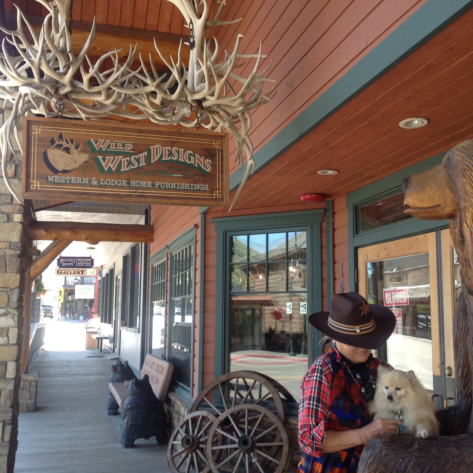
This last photo was taken of Cowgirl Kathy and her faithful companion Cabo both sitting next to Mark Twain which is a bit strange since I doubt Mark Twain ever visited Jackson Hole. But then, who cares.


We are leaving Jackson, Wyoming tomorrow morning for Idaho Falls, Idaho and we sincerely hope that are new destination is far less crowded than our present one.  Jackson was a fun place to visit for a short period mostly because the scenery is so beautiful, but it would be no place to live.  I know . . lots of people obviously disagree and that is why real estate is hugely expensive in this town.  


Wednesday, June 17, 2015

Chapter 12 - Dubois to Jackson, Wyoming

Tuesday, June 16th:
The drive from Dubois to Jackson was only 90 miles but we knew that to get there we needed to drive over the top of the Rocky Mountains and through a pass named Topwotee Pass that rose to an elevation of 9,659 feet above sea level.  The pass was around 40 miles from our campsite which sat at an elevation of around 6,900 feet. This meant that in 40 miles we would have to climb 2,759 feet.  Our car had a capacity to pull a trailer weighing up to 3,600 pounds and we knew that unloaded the trailer weighted about 3,200 pounds. The question was how much junk was loaded in our trailer and would we be able to make the climb without any problems. The photograph of Kathy and Cabo with some snow in the background was taken at Topwotee Pass so yes, we were successful and thankfully as a result our trip will continue.

Almost immediately after crossing the Continental Divide and the Topwotee Pass and we started our descent another magnificent mountain range came into view which we knew to be the mountains of the Grand Teton National Park. These beautiful mountains were visible off to our right for the rest of our 40 or so mile drive south down to Jackson, Wyoming, often called Jackson Hole. Jackson is located just south of the entrance to the Grand Teton National Park.  Our plan was to get set up in Jackson and then spend the remainder of Tuesday exploring the city before visiting Grand Teton National Park the following morning.

Our RV park is named The Virginian RV Resort, and it is located right within the city of Jackson which undoubtedly accounts for the reason that it was so expensive and so very crowded. I have never been very proficient at backing up our travel trailer and this crowded park with its relatively small parking spaces really testing my skills, or my lack of skills, as the case may be. My only saving grace was that when our new neighbor arrived with his travel trailer, he too did a poor job backing in. Perhaps it's just our age and our lack of practice. At least we are spending three nights here at the Virginian, so my embarrassing backing up efforts will be quickly forgotten. One thing about this RV park despite the fact that it was crowded and expensive, the setting of the park surrounded by mountains is really pretty as this photograph somewhat shows. Incidentally, the photo was taken before the park filled up for the night and the "No Vacancy" sign was hung at the front gate.  After visiting the crowded downtown area in the afternoon so Kathy could pickup a few souvenirs, we spent a quiet evening reading and watching TV, and then once again we had a pleasant sleep with the temperatures dropping into the high 40s.

Wednesday, June 17th.
We woke up to sunny skies and with a promise by the local weatherman that the temperatures would rise into the low 70s.  Today we were really excited for we were going to spend a good part of the day visiting the Grand Teton National Park.  We knew that we needed to get an early start for the traffic was heavy yesterday along the highway that passed by the park, and the City of Jackson was crowded with tourists both suggesting that the park will also be crowded.  We arrived at the park when it opened at 8 AM ready and willing to pay the $30 entrance fee. As I handed the girl at the entrance the fee, she immediately asked my age.  When she learned both of our ages (she did not ask about Cabo) she offered us for a $10 fee a lifetime pass to all national parks because we were both over 62 years old.  What a pleasant surprise especially since it meant that there would be no fee when we visited Yellowstone Park later during our trip home.  You can see in the photograph just how happy I was to receive a lifetime pass to all federal parks just because we are old.  Wow!  

Over the next four hours we had one of the most memorable experiences of our lifetime.  Honestly we can not remember ever seeing such awesome and inspiring views.  There are lots of photos of the Grand Tetons available in books, magazines, online, and those of course that we have attached, however nothing can duplicate what can be seen in person by the human eye. Both Kathy and I remarked over and over again as we left the park and drove back to our campsite, that if nothing else, this day alone made our whole trip out west worth the long drive.  I am ending this days blog with a few more photos that should speak for themselves.  Incidentally, if you have not already discovered, the photos in this blog may be enlarged simply by clicking on the photo.

More about our Jackson Hole visit to follow in a later blog.  This entire chapter was written in a local Jackson library simple because the WiFi system in our expensive RV Park was worthless.  Go figure.


Monday, June 15, 2015

Chapter 11 - Casper to Dubois, Wyoming

Sunday, June 14th:
The photograph to the left does not adequately show the beauty of the drive today.  No photograph can. The rock formations, the herds of cattle, the antelopes, and the snow covered mountains in the distance that rose to over 13,000 feet.  The mountain range that shows faintly in the photograph came into view about two hours into our trip and for the next hour and a half we followed these mountains all of the way up to Dubois. Our map told us that these were the Wind River Mountains and that along the ridge of these mountains ran the Continental Divide. We were also intrigued by the name of the mountains for we knew that our campsite for tonight and tomorrow night, The Longhorn Ranch Lodge and RV Resort, sits along side the Wind River and our reserved space in the park sits directly on the river bank.  Obviously our destination will be close to the mountains and as it turned out, the town of Dubois and the Wind River sit deep within a valley which carries the obvious name of the Wind River Valley.

The drive today was almost entirely void of 18-wheelers and not surprisingly there were almost as many travel trailers as there were cars. Fortunately the traffic was light. The highway that we followed to Dubois continues on to Yellowstone National Park which clearly explains the abundance of trailers like our own. The numerous cattle ranches along our route would also explain our delightful delay having to wait for a team of cowboys to drive a small herd of cattle across the highway.  We have never in our 46 years of marriage and traveling together encountered a "cattle drive" delay.  Got to love the west!

About five miles south of the RV park where we plan to spend the next two nights, we pulled off the road because the view of the Wind River and the adjacent rock bluffs was just too much to pass up. On the drive up to Dubois we have crossed the Wind River several times.  In some locations the water was rushing at such an intensity that white water rafting on the river would have been a thrill.  In other locations the water was not quite so intense but it was still moving at about ten miles per hour. Fly fishing for trout in the Wind River is a popular local sport and a tourist attraction. The source of the Wind River is of course in the Rocky Mountains. As with other rivers in the west, the waters of the Wind eventually end up in the Mississippi River and ultimately in the Gulf of Mexico.

As I mentioned our campsite at the Longhorn Ranch is right on the bank of the Wind River and as this photo to the right shows it is nestled among a collection of large cottonwood trees. We were fortunate that the RV park was only around 30% occupied as both Kathy and I agreed that our RV space located right on the river bank has to be one of the best and most popular in the park.


The photograph to the left of the Wind River was taken about 100 feet from our travel trailer. We had an unobstructed view of the river Sunday evening while we enjoyed dinner sitting at our picnic table under our awning.  Hard to ask for more, especially with a blue sky and temperatures in the mid-70s. If a nice home were built on this lot it would be worth in the hundreds of thousands of dollars. Despite the incredible beauty of the area along the river, we were surprised not to find any really deluxe homes sitting along the river. Perhaps most of the local residents preferred to spend their money on homes on mountain sides with incredible mountain views.

For dinner tonight, Cabo and I enjoyed the most incredibly delicious grass fed Angus beef burgers that I cooked over our grill. The beef was purchased at a local food store and obviously we can thank a local cow for providing his life to give us such a treat. Kathy as a die hard vegetarian, missed out on this wonderful meal. A salad dinner just does not do it for me.


Monday, June 15th:
We woke up this morning with the temperature outside and probably inside our tin box, at a cool 46 degrees and for a few minutes we found it necessary to turn on our heater. Please, I know we are campers, but really, we were just not prepared to take a shower even with really water hot, when the temperature in our bathroom was in the 40s.  This quickly changed however, with the heat soon flowing in our 130 square foot home. Unfortunately, the skies were cloudy and according to the local weather forecast there was a strong chance of rain. Notwithstanding the weather, we were enjoying ourselves, so at 9 AM we enthusiastically set out to explore Dubois, Wyoming.  After driving through the streets of Dubois which did not take us very long in this town of only 950, we soon found ourselves driving up a steep gravel road identified with a sign at the bottom as a scenic overlook road. Despite the low lying clouds, the view from the top of the mountain after we slowly climbed uphill for 15 minutes was just incredible. Unfortunately as we wound our way back down the mountain it started raining.

Not really discouraged by the rain we decided to visit a local museum that featured local area history as well as the local wildlife. The Dubois Museum was really wonderful and because we were the only visitors on this rainy Monday morning, the museum curator gave us a personal guided tour. She was gracious enough to take several photographs of Kathy, Cabo, and myself including this one to the right. With the rain still coming down we decided to return back to the park and wait out the storm.


By the early afternoon the weather greatly improved (at least the rain stopped) so we decided to give our tourist enthusiasm another try and take a drive out into the countryside.  If nothing else we also needed to fill our car with gas.  Just to the south of our RV park we found another gravel road that seem to head up into the mountains so we decided we would give it a try.  I cannot even hope to describe how beautiful the scenery was as we wound uphill. Off to our right we saw a horse rider off in the distance. A perfect picture if we had a better camera.  Rocks and scraggly trees dominated the hillsides and off in the distance were tall mountains, many with snow on their tops. We discovered as we drove for a couple of miles, that this road led to a viewing area where Bighorn sheep are viewed on the high mountain sides during the winter months. Both Kathy and I cannot remember ever visiting an area where we were more awed by the beauty.  What a trip. This photo of Cowgirl Kathy Baker and Cabo is the best that we can do to share the beauty of what we have discovered here in northwestern Wyoming.

Tomorrow we are going to challenge our car by asking it to pull our trailer over the Continental Divide and across the Togwotee Pass at 9,658 feet above sea level.  We will let you know in our next blog whether or not we made it unless of course we end up like the Donner Party in 1847.                


Saturday, June 13, 2015

Chapter 10 - Cheyenne to Casper, Wyoming

Saturday, June 13th:
Today be woke up to blue skies and warmer weather, at least warmer by Wyoming standards as it was in the high 60s by 7 AM with mid-to high 70s expected by mid-day. This was ideal weather for our 3-1/2 hour drive north out of Cheyenne up I-25 to Casper, Wyoming a distance of around 180 miles. Besides the beautiful weather, the traffic on the interstate 25 was very light as the photograph to the left clearly shows. The scenery was interesting consisting again of rolling green hills but as the photograph also clearly shows there were almost no trees and the few trees that we did see were around the farm buildings and along the few creeks that passed alongside or under the interstate.  Kathy did see on several different occasions in the distance, small herds of what she thought were antelope.  These animals were in addition to the frequent herds of cattle that dotted the landscape during most the morning.

Here and there alongside the highway were lovely rock outcroppings or bluffs but the only mountains that we could see and then only faintly were in the distance off to the west. We learned later that these mountains were the Laramie Mountains. At the very north end of this Laramie Mountain range located just south of the City of Casper and fairly close to our highway, was a mountain appropriately named Casper Mountain. We were pleasantly surprised that we could see Casper Mountain from our RV park which incidentally was located alongside the North Platte River. Not surprising the park was named River's Edge RV and Cabins Resort. Shortly after we got our trailer all hooked up, we decided to drive to this Casper Mountain and check out the view from the top.

The above photograph of Kathy and Cabo looking down from the top of the Casper Mountain does not and cannot due justice to the view. It was just incredible. The photograph to the left shows the rock outcroppings of the mountainside and it gives a clear picture of just how steep a climb we made as the two lane road wound up the side of the mountain. The mountain looks down at what might be called the North Platte River Valley and it was through this valley and along side the North Platte River that the Oregon Trail passed. When we arrived at our RV park we were handed as we registered, a map of the City of Casper which contained a dotted line across the map that showed the actual path of the Oregon Trail.  The path quite to our surprise and perhaps skepticism, passed right through the location of our RV park. Wow! Maybe our travel trailer is actually sitting on a long ago wiped out rut from a wagon wheel. And to think that we like the settlers of old are headed for Oregon.

The photograph to the right was taken at the edge of the North Platte River looking west down the river. I took the photograph after only a two or three minute walk from our trailer.  There were no actual trailer sites down on the river's edge probably due to the possibility of flooding. While they cannot be seen in the photograph, just north of the river was a whole line of massive wind powered turbines. The view of the turbines reminded us immediately of the strong winds that we encountered while driving up the interstate this morning. It was definitely a bit unnerving driving the car pulling the trailer while it swayed back and forth in the wind. At least the wind and the turbines are generating electricity and not destroying my nervous system.

We are staying in Casper only this one night since the RV park did not have a space for us for an additional day and night. Perhaps this will work out OK since we drove through metro Casper and the city did not impress us much. Perhaps our short pass through the city may have been a bit unfair by not giving us an opportunity to see its best features like its museums, parks, etc. but then we may never know. Tomorrow however, is a longer drive on our first non-interstate road so perhaps it is just best that we rest up this afternoon and evening and prepare for our drive up to DuBois, Wyoming, our last stop before visiting the Grand Teton National Park and Jackson Hole, Wyoming.        


Friday, June 12, 2015

Chapter 9 - Ogallala to Cheyenne, Wyoming

Thursday, June 11th:
We could not help ourselves.  We were up at 5 AM after a great sleeping night.  It rained hard last night and while the sound of the rain on our aluminum roof woke us up initially, its hypnotic affects quickly put us back into a deep sleep.  Anyway, it was light out by 5 AM so it seemed natural to get up and have breakfast. The rain was over and the sun looked like it might even peek out from behind the clouds.  We left the RV park by 7:30 AM, on the road once more this time headed to Cheyenne, Wyoming only 170 miles to the west.

You may be getting tired of my reporting on the changing scenery but once again one of the most wonderful things about driving across our country are these dramatic changes in the scenery. We have left behind the green fields of corn and the land now is mostly covered with just prairie grass interrupted occasionally by a farmhouse with its barns and silos, and here and there, by small herds of cattle. It seemed to us that every cow must require at least 100 acres of grass or more since there is so much empty land and so few cows. As we continued west the grass appears dried out despite the fact that rain has been abundant and well above average for this time of year. We realized as we arrived in Cheyenne and have had a chance to slow down that the leaves on the trees are just starting to come out. It is still early spring here in Southeastern Wyoming. The higher altitude and the cooler weather has much delayed the growth of the grass and the leaves on the few trees in this area. We also realized that many of the fields have been tilled but nothing yet has been planted.  As I write this blog it is 4 o'clock in the afternoon and the temperature outside is only 56 degrees.  It is expected to go down into the low 50s tonight.  No wonder the trees and plants are so far behind what we are used to in the east and at the lower altitudes.  The photo above shows our car and trailer parked at a rest area about 100 miles east of Cheyenne.  Interstate 80 was mostly straight as an arrow and not at all crowded. The 18-wheelers outnumbered the cars by two to one.

Our RV park was not initially our first choice but as it turned it was probably a better place to stay than the more well know KOA that we had originally chosen in Cheyenne. Our campground was not only closer to the city, but many of the sites enjoyed shade from trees. Plus as we later learned, they had within the A.B. Camping RV Park, a small BBQ restaurant that served an excellent pulled pork meal that I thoroughly enjoyed for dinner. The beef and the pork was actually cooked in a big outdoor wood burning stove located only a few steps from our travel trailer site. Unfortunately, the cool weather and the off and on again rain that continued through most of the afternoon dampened our enthusiasm to be tourists, although we did eventually take a drive into the city.  Our drive however, proved to be invaluable for it convinced us that Cheyenne was by far the most interesting city that we had so far visited to date. We returned to our campground excited that tomorrow with its projected better weather, would be a fun and educational experience exploring the City of Cheyenne.

Friday, June 12th:
Like the smaller City of Ogallala, Cheyenne's owes its beginnings to only one thing, the Union Pacific Railway.  Unlike Ogallala however, Cheyenne has gone a long way to preserve its heritage though its numerous museums, art galleries, theaters, and parks. In 1867, a tent city was established on the site of the present day city, that housed the workers on the construction of the first transcontinental railway. The railroad and the cattle drives that subsequently followed created a city that today is the State Capital of Wyoming and has a population of 46,000 people.  The photograph above hangs in the Cheyenne Depot Museum and it was taken around 100 years ago. The area today looks pretty much the same as it did in this photograph. Most of the many railroad tracks are still in place and trains still pass through the city during much of the day and night.

The building in the photo which was at the time the train depot is now a museum that displays the history of the railroad as it pertains to Cheyenne. We spent over an hour in the museum (and the gift shop) and it was worth the visit.  Fortunately Cabo was allowed into the building at no extra charge although as you can see in the photograph he showed very little interest in the history of the railroads.      


Another interesting museum that we visited was located in a large city park just north of the downtown area that they called Frontier Park.  The museum was named Cheyenne Frontier Days Old West Museum and it focused more on the earlier settlers and the cowboys than on the railroad. The photograph of Kathy and Cabo under the cowboy riding a bucking bronco was taken just outside the museum.  Behind the statue to the right in the photograph sits the stadium that holds annually according to Cheyenne, the World's Largest Outdoor Rodeo. The rodeo begins on July 17th this year and Kathy and I joked that had we arrived in Cheyenne on this date, it is doubtful we would have found an RV park that had any available spaces.

Cheyenne is filled with many other attractive and historic buildings including Wyoming's State Capital Building that is shown in the photo to the left. The photo also shows Kathy on the lower right stealing pine cones from one of Wyoming's evergreen trees. Just kidding, but the tree was covered with cones. After around four hours of touring this very interesting city, we returned to our campsite so that could get a few things done like planning our trip tomorrow, writing our blog, cleaning some of the bugs off our trailer and car (a never ending task), and in Kathy's case, doing our laundry.

After completely our visit to Cheyenne and its many tourist attractions and then doing the laundry, Kathy and Cabo decided to take a short rest on our bed. They are surrounded by pillows and pillow cases that Kathy has been collecting as we travel across our country. Tomorrow we are changing course and we are heading north up Interstate 25 for Casper, Wyoming where we will be spending only one night before heading out to DuBois, Wyoming on the way to the Grand Tetons in northwestern Wyoming.  The City of Casper, Wyoming's second largest city, is on the North Platte River so once again we will be briefly following the Oregon Trail.


.

Wednesday, June 10, 2015

Chapter 8 - Grand Island to Ogallala, Nebraska

Tuesday, June 9th:  
Our drive to Ogallala (named after the Ogala Sioux Tribe) will be our shortest daily drive since we left Florida two weeks ago.  The total distance will be just under two hundred miles and if we make only one rest stop and no stops for gas, then we expect we will be on the road only 3-1/2 hours. Despite the obvious fact that there was no reason to get on the road early, Kathy and I being creatures of habit ending up rising at 6 AM and hitting the road by 8 AM.  This schedule would have placed us in Ogallala in southwestern Nebraska by 11:30 AM were it not for one important fact that we had over looked - we passed into the Mountain Time Zone as we drove down I-80 and immediately we had to set our clocks back one hour.  We arrived at the Country View Campground at 10:30 AM their time which probably made us the earliest arrival in this campground's history. Only an older couple traveling without children could accomplish such a feat.  You might see in the above photograph in the distance our small travel trailer and you might also see that the RV park was almost empty.  Fortunately for the owner of the park by the evening the park was almost half full.  From our standpoint "not crowded" is always a real positive.

Once again as we drive across our country we are amazed at how much the scenery changes over relatively short distances.  When we left Grand Island in eastern Nebraska the flat lands on both sides of the interstate we covered as far as the eye could see with young corn plantings.  As we traveled west the corn plantings diminished and soon the farmlands were obviously cattle ranches and much of the land was planted with wheat. And while the rise in elevation as we crossed the country to the west was not particularly discernible, we know from research that the elevation in St Louis was 465 feet above sea level, rising to 1,160 feet by Kansas City, then 1,860 feet in Grand Island.  Our cabin in the Blue Ridge Mountains in North Georgia was around 1,800 feet above sea level and it seemed so much higher than the flat countryside of eastern Nebraska.  The rise in elevation as we drove the 200 miles from Grand Island to Ogallala was much more dramatic rising from 1,860 feet to 3,222 feet although here again the rise was so gradual that it was not noticeable. This Thursday we will continue our Oregon Trail Trip by driving to Cheyenne, Wyoming, a distance of around 170 miles. Perhaps by this leg of our trip we will finally notice the rise in elevation. Cheyenne has an average elevation of 6,115 feet above sea level or a rise of approximately 2,900 feet above our RV space here in the Country View Campground.  I sure hope we will be able to breathe at such a high elevation. The photograph to the right above shows Kathy and Cabo entering a gift shop in Ogallala that was disguised for the tourists' benefit as an old jail circa late 1800s.  I was smart enough not to enter the jail this day.


After a brief drive through downtown Ogallala, followed by a stop at the gas station and a trip to Walmart, we pretty much spent the afternoon inside the air conditioned interior of our travel trailer as the temperatures outside were near a record breaking 92 degrees.  The average high temperature for this date in this area is only around 80 degrees so it is no wonder that some of the local residents were complaining about the heat. While we had never heard of Ogallala, Nebraska before deciding to stop here on our way to Oregon, it turns out that the city does have an interesting history although it is mostly unrelated to the Oregon Trail. While most of the emigrants heading west followed the north branch of the Platt River which passes just north of Ogallaga, the south branch of the Platt (photograph above) which does pass through Ogallala did see some emigrant activity plus the area was also on the path of the famous Pony Express which operated from April 1860 to October 1861 as well as being on a stage coach route.  It was not however, until the Union Pacific Railroad established in 1867 a stopping point in the area with the construction of a house and a water tank, that the town had its origins. Orallala's real claim to fame began in 1873 when it became a destination point for Texas cattle drives along with other such cities as Kansas City and Cheyenne. The cattle drive to Ogallala became known as the Texas Trail and by 1876 as many as 125,000 cattle were herded to the city where they were loaded on trains bound for Chicago. During the summer months Oragalla became the host to a multitude of cowhands, cattle barons, saloon operators, gamblers, dance hall girls, and tradesmen - a rough and tumble wild west town soon to be well known as Nebraska's "Cowboy Capital."  Ogallala reign as the "Queen of the Cowtowns" ended after only a decade in 1885.

Wednesday, June 10th:
Today we will explore the town of Ogallala. Unfortunately very few of the old original buildings have survived today in Ogallala and virtually nothing has survived that reminded us of the town's Cowboy days. They have their own Boot Hill cemetery where many of the cowboys were buried but it is a little disappointing in that most of the old gravestones were destroyed over the years.  Apparently the cemetery was used by children as a sledding hill and as they road their sleds down the rather steep hill they occasionally crashed into and broke off the small headstones. Before the historical significance of the cemetery was recognized which was only just recently, the local residents apparently disposed of the headstones as trash.  

While there does not appear to be any of the original gravestones in the cemetery, the statue of a cowboy on his horse that sits in the center of the graveyard was worth the visit even if the statue was not actually placed in the cemetery until 2007. Boot Hill as you can see in both of these photographs is covered with weeds which does have the visual effect of making the place look kind of old, mysterious, and abandoned. We suspect that the city leaves the cemetery looking this unkempt on purpose.  


Not far from the Boot Hill Cemetery sits one of the oldest surviving houses in Ogallala which was built in 1887 shortly after the demise of the cattle shipping industry in the city.  We did not visit the interior of the "Mansion on the Hill" for a number of reasons not the least of which was the presence of Cabo, although the exterior of the building was worth a photograph. The mansion unfortunately is located on an otherwise commercially oriented street which has the effect of detracting from its charm.


We suspect that the tourist attraction that draws the largest crowds to Ogallala are not the few historical attractions that we have mentioned and photographed above, but the large Lake McConaughy that was created beginning in 1936 by the construction of the Kingsley Dam on the North Platt River.  The lake created by the damming of the river covers 35,700 acres and contains 76 miles of shoreline. We were able to drive across the top of the dam and the view looking east down the North Platt River is spectacular as somewhat shown in this photograph despite the intrusion of the old man partially blocking the view.

The weather today has been cooler rising to only the low 80s by mid-afternoon.  Rain is expected this evening. Tomorrow we are driving to Cheyenne probably in the rain and the high temperature about the time of our arrival is projected to be only 64 degrees.  Truthfully, we cannot say that we only expected great weather during the full length of our trip, but at the same time, wet weather with a high in the low 60s and a low in the high 40s is about as bad as any crummy winter day in southwest Florida. This we did not expect. Oh well. Our trailer has a heater. We brought warm clothes.  We have lots of good books. Food and drink. The TV works. "Who could ask for anything more."