Tuesday, July 21, 2015

Chapter 30 - Walla Walla to Clarkston, WA / Lewiston, ID

Monday, July 20th:
Our drive this morning over to Clarkston, Washington is only 100 miles and maybe will take as long as 2-1/2 hours. Considering this rather short drive we tried our very best not to leave too early, but despite our best efforts, we arrive at our next campsite by 10:30 am. Our planned stay for the next two nights is at the Hells Canyon Resort which is located directly on the Snake River in Clarkston, Washington. Clarkston is located directly on the Idaho Washington state line and directly across the river from Lewiston, Idaho. 

Our drive was very lovely and interesting. While the road was only two lanes the traffic was light and when a few cars did pile up behind us there were plenty of pull over stops to let cars pass us by. At first the hills near Walla Walla were covered with wheat as far as the eyes could see but as we traveled further west the wheat was replaced with dried grass and rocks and the rolling hills changed to rugged mountains. As we have said so many times in the past, the scenery in our country is really diverse and it can change rapidly in only a matter of miles.   

Our RV Park came as a pleasant surprise amidst all of these rugged mountains. The park sat directly on the Snake River and the space that we were assigned had an unobstructed view of the river and the surrounding heights.

The RV park offered only full service hookups (even the internet worked), it was clean, our parking space was concrete and wide, and the grass between the spaces was green.  Our only surprise was that the park was only around 25% occupied. It is no wonder that our early arrival was not a problem. The low occupancy however, worked to our advantage such that we were given an excellent parking space such that our front porch (under the awning) directly faced the river and the mountains beyond. I was standing right next to our trailer when this photo was taken.


Since we had arrived earlier than usual today we decided to get out and do a little serious touring before the temperatures climbed much higher.  There are a lot of choices here in the Lewiston/Clarkston area.  These two adjacent cities sit right at the confluence of the Snake River and the Clearwater River.  The combined rivers runs westward and connect to the Columbia River. The Snake River connects into the Clearwater River from the south passing through a deep canyon known as Hells Canyon after which our RV park was obviously named.  The smaller Clearwater River gained its fame when the Lewis and Clark Expedition descended the Clearwater River in dugout canoes in 1805. It was near the present day city of Lewiston where William Clark first encountered members of the Nez Perce Indian Tribe. The western boundary of the Nez Perce Indian Reservation is located just east of Lewiston. Two places that we had to visit were clearly the Hells Canyon and the Nez Perce Reservation. Since both of these sights required a longer drive time than we wished to do today, we selected instead to visit The Hells Gate State Park which was located on the Idaho side of the Snake River just before the entrance into Hells Canyon.  Hence the name "Hells Gate."

Hells Gate State Park is a large 960 acre park that runs for a mile or more along the Snake River.  At the far end of the park is a large campground that sits among numerous large shade trees (unlike our own park) and while the campground was scarcely occupied during our drive thru, when we checked later at the registration office they told us that their campground was almost 100% occupied on the summer weekends.  This state park was also covered with numerous wide and paved trails that are undoubtedly popular for walking, jogging, and biking.  Most of the trails offered wonderful views of the Snake River and the cliff walls on its far side.  After our short drive through the park, we visited the Lewis and Clark Discovery Center near the entrance to the park where quite to our pleasant surprise Cabo was allowed to enter. The exhibits inside the center focused entirely on the Lewis and Clark Expedition with a special emphasis on their passage through the Lewiston area. Plus it should come as no surprise that inside the Center they had a very well stocked gift store.  The Center itself sat directly on the Snake River. This photo of Kathy and Cabo was taken immediately on the river side of the building.

We also wanted to include this photo of Kathy and Cabo standing in the canoe as it too was taken on the river side of the Discovery Center but with the Snake River in the background.

Once our touring of the Hells Gate State Park and the Lewis and Clark Discovery Center was completed we returned to our campground to enjoy the remainder of the day in the comfort of our air conditioning.  The temperature was once again into the high 90s.


This final photograph of the day was taken right at sunset about 9:00 PM Pacific Coast Time.  The silhouettes in the foreground of the picture are William Clark and Sacagawea who had recently joined us for cocktails and were on their way home.

Tuesday, July 21st:
We mentioned earlier our plans for today: The Nez Perce Indian Reservation, specifically the Nez Perce National Historical Park located about 15 miles east of our campsite, and Hells Canyon located south of Clarkston, distance unknown.  Before we left on our tourist excursions Kathy ran over to the local Walmart for a few needed supplies and I took this sunrise photograph. Wow, hard to believe.  William Lewis and Sacagawea are still out front; they never went home?


Unfortunately when we arrived at the Nez Perce National Historical Park we quickly learned that Cabo was not allowed inside their building, so while Kathy checked out their gift store, Cabo and I walked around outside their building and read some of their historical markers including one marker that immediately caught my attention. Just down below the visitors center was an historical park named after an early missionary who used to live there.  His name was Henry Harmon Spalding and he and his wife Eliza Hart Spalding moved there to work with the Indians back in 1836.  Kathy asked me, when she heard the name Spalding, whether he was one of my ancestors since she knew that my grandmother's surname was Spaulding.  When we returned to our campground later in the afternoon, I looked up Henry Spalding on Ancestry.com (I am an avid fan of such a thing) and discovered that Henry was my 5th cousin, 6 times removed and that he was born in Steuben County in New York State.  My grandmother Helen Spaulding and several generations of her ancestors were all born in Steuben County.  Go figure.
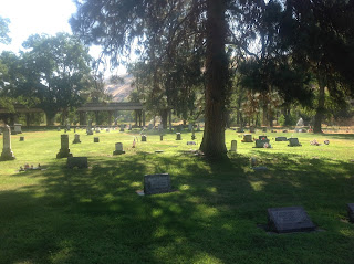
We drove down into the old settlement of Spalding and viewed an old cemetery where we learned later there is a memorial to Henry and Eliza Spalding.  There were also some old homes in the settlement although none of them were around at the time the Spalding family lived in the area.  The area was very pretty and loaded with large shade trees and a lovely creek that flowed through the old settlement and into the Clearwater River. Based on what one of the park rangers told us about the history of the area, the Nez Perse Indians used to burn their land because it helped reseed their plantings, so we have to wonder if Henry and Eliza Spalding lived on land that was mostly void of large trees. Whatever their conditions, you have to admire anyone who would give up their relatively comfortable life in the East to go live with the Indians back in the early 1800s.

One problem along most of the major rivers out here in the west is that the wind down the river gorges can blow pretty strong by the mid-afternoons.  We experienced this at our campground on the Columbia River as well as our campground here on the Snake River. Apparently the Park Rangers here at the Historical Park also have the same problem since we had fun watching and talking with them as they erected a tent in front of the visitor center.  From what they told us the tent has to be put up and taken down almost daily. Kathy and I were asked if we wanted to help and when we said yes, we were given small sticks that were used to hold the two sections of canvas (not Buffalo hides) together. At that instance I guess we became honorary Nez Perse Indians.


Our second tourist adventure for the day was to drive down Hells Canyon if that was even possible.  We had been told and we read in some of the tourist magazines that you could take boat excursions down the river, but we were not sure whether or not a road followed the Snake River into the deep canyon.  Much to our pleasure a narrow and winding road did follow the river which we followed for almost twenty miles before finally turning around.  The scenery was unbelievable and perhaps if we had more time and Cabo was not with us we might have taken one of the many excursion boats that we watched navigating the river. Whether in a boat or on the road, the trip into the Hells Canyon was a life time experience.


We took many photographs of our drive down the Hells Canyon every one of them however, can only give a suggestion as to the beauty of this area. This was our final tourist activity for the day.  We returned to our home on wheels, relaxed as always, and prepared for another long drive tomorrow, all the way to Missoula, Montana.

Monday, July 20, 2015

Chapter 29 - Oregon to Walla Walla, Washington

Saturday, July 17th:
We said goodby to Joan and Terri early this morning and we were "on the road again" by 7:30 am headed for Walla Walla, Washington. We learned last evening that the temperatures in Oregon were again on the rise and a quick check of what we were to expect in Walla Walla revealed the same, highs expected in the mid-90s. You know this is ridiculous. The high temperatures in Estero, Florida on Saturday are projected to be lower than in Walla Walla, Washington. Who would have thought. Anyway, our drive to Walla Walla will take us a little over 4 hours and most of the drive follows the Columbia River.  This photo was taken only a few minutes before we finally left the Interstate and the Columbia River and we turned east on to Hwy 12 that soon took us into Walla Walla.


Our destination in Walla Walla was the RV Resort Four Seasons which thanks again to Garmin we easily found. While this RV park was a highly rated, full service, and very clean RV park it was a bit of a disappointment visually particularly after spending two weeks in scenic Oregon.  Nevertheless, we were determined to get back into the rhythm of staying in nice places and moving every several days.  Incidentally, in this photo of Kathy next to the fountain our travel trailer can be seen way in the distance behind and to the left of the red car.


The owners of our RV park must have inherited a whole bunch of animal statutes for they were placed all over the park.  We took a lot of photos of the statutes but this one of Cabo admiring the panther is our favorite one.  Cabo doesn't seem to fear other animals (made of concrete.)

We spent most of our early afternoon studying a list of the historical and other tourist sights in and around Walla Walla as frankly, I had never heard of Walla Walla until recently.  Kathy on the other hand knew that Walla Walla onions were famous. Really?  What we learned about this city in our brief study was quite interesting. Walla Walla has a population of around 32,000 much larger than we assumed.  The name Walla Walla is Native America and means "place of many waters." The Lewis and Clark Expedition passed through the area in 1805 and the area was first settled by fur traders back in 1818 and by missionaries in 1836. Many of the downtown area businesses and stores occupy buildings that were originally constructed in the late 1800s and early 1900s and the buildings still retain the charm of the original architecture.  And finally, in 2013 Walla Walla was recognized by Fodor's as one of the "10 Best Small Towns In America," and in 2011 Walla Walla was voted "America's Friendliest Small Town" by USA today and Rand McNally. We also learned that there are a few historical buildings in the town including at least one historical museum.  What a surprise Walla Walla.

One problem with visiting Walla Walla this afternoon was that the temperatures had now risen to the high 90s which would make walking around the city very uncomfortable.  We decided instead just to tour the city briefly in a car and then quickly stop by a supermarket to shop for a few needed supplies and then return to our air conditioned "home" to relax this afternoon.  We will put off exploring the downtown area until tomorrow morning when it will be cooler.  One store that Kathy immediately noticed as we drove downtown was Macys. If a town as small as Walla Walla has a Macys then there must be something special about this place. Incidentally the highrise building in the background of the photo of Macys is the Baker Building built in 1911. Don't ask.

Sunday, July 19th:
One of the brochures that we picked up yesterday at our RV park was a "Downtown Historic Trail Guide" which basically consisted of a detailed description of a 1.5 mile walking tour of the downtown area of Walla Walla.  The guide gave us the age and a brief history of some of the older and more historic buildings. We were also informed by the guide that the Sunset Magazine had named Walla Walla as having the Best Main Street in the West.  Even I, the proverbial I hate shopping guy, was a bit gunned up. Fortunately we started our walk around 10 am Sunday morning before many of the stores had opened so that our walk was just an historic tour. 

I remember when I was in my early 20s in Niagara Falls when the New York State Urban Development Corp sponsored the demolition of almost all of the old buildings in our downtown area in the name of "urban renewal." I was working for a general contractor at the time so the prospect of lots of new construction projects should have uplifted me, but it did not. What was built to replace the old historic and charming buildings was awful especially architecturally. Niagara Falls never recovered from this huge error in judgment.

On the other hand, Walla Walla took a different approach and kept and restored their old buildings. I use the word restored and not improved as for the most part the original appearance of the buildings has been maintained.  One of the other features of this downtown area that both Kathy and I loved was that the Main Street was tree lined and potted plants hung from each of the lamp poles. Considering how dry the climate is around here and the fact that has been very hot in this region so far this summer, it is obvious that the City of Walla Walla is devoting the necessary time and money to maintain these flowering potted plants.

Another very unique thing that we observed during our almost two hour walk, was that Main Street had numerous restaurants, coffee shops, and winery tasting rooms and most of them had little fenced in outdoor eating or wine tasting areas. It was not apparent from our drive into Walla Walla yesterday but apparently the surrounding county is filled with vineyards. I did not try and count all of the tasting room we passed on our walk, but I would guess that there must have been at least two dozen.  Too bad it was a Sunday morning or I might have had a few sips of Walla Walla Valley's finest dry white wines.

Not to be outdone, Walla Walla also has tried its hand at mural painting but in their case it is going to be hard to improve on what we found in a small park area right on Main Street in the middle of the shopping area.  We took maybe two dozen photographs of this city during our walking tour and it would be impractical to try and place them all in this blog. I must say that I never thought that I would admit that I enjoyed walking through a downtown shopping area, but Walla Walla has proven to both Kathy and I that history and modern shopping can be blended together to make something special.  Walmart - eat your heart out!

Our plan for this afternoon was to stop at the Kirkman House Museum followed by a visit to the Fort Walla Walla Museum.  We did visit both museums although in both cases we were not allowed to enter the facilities because dogs were not allowed.  We did take this nice photo of the Kirkman House which was built in 1880 and Kathy did visit the Fort Walla Walla Museum only to get as far as their gift store (while I waited outside with the rejected Pomeranian.)  On our return to our RV park we noted a large sign on one of the local banks showing that the outside temperature was now 101 degrees.  That is way too high to play outside. We spent the rest of the day in out air conditioned travel trailer, writing this blog, reading a book, having a cocktail, eating dinner, watching TV, and finally going to bed early.  What a life!  Tomorrow we head east again to the combined cities of Clarkston (Washington) and Lewiston (Idaho).         

Sunday, July 19, 2015

Chapter 28 - Cascade Locks Day 3 and 4

Thursday, July15th:
Since we first visited the west coast of Oregon the weather has been cool and for the most part sunny. I suppose we have become somewhat spoiled which might explain why I was a little disappointed when we awoke this morning to cloudy skies and what looked like the possibility of rain. Our plan today is to cross The Bridge of the Gods into Washington, drive down the Columbia Gorge eastward, and then return back on the Oregon side again following another section of the historic and scenic highway.  This photograph is of the Bridge of the Gods taken yesterday when the sky was blue and the sun a shining.

There was an old Indian legend that when the tall gorge walls collapsed into the river about a thousand years ago and created a natural dam in the area of the Cascade Locks, it was an act of God.  For the Indians the rocks in the river provided them a means of crossing the river, thus we derived the name the Bridge of the Gods.  The construction of the current bridge began in 1920 and it spans over the river a distance of 1,854 feet. As you can see in our photo of the bridge as we are crossing, there were lots of clouds around us.


Our first stop once we arrived in Washington State was at the Columbia Gorge Interpretive Center just off the Lewis and Clark Hwy that we were following east.  As it turns out we did not go into the center mostly because of the two dogs, but we did walk around the grounds looking at the old railroad engines and cars, and the old farm and construction equipment. One railroad engine looked like it might be suitable for dogs only due to its small size, so we obliged.  I wonder what "P & S" stands for?


The Lewis and Clark Highway was very lovely although not quite so much as yesterday's historic trail along the Oregon side of the river.  We did pass through a number of small towns some of them quite industrial in nature where we could see between our road and the river large timber mills processing lumber possibly for shipment overseas to such counties as China. Most of the towns were older in appearance which added to their tourist appeal.  By far however, the most interesting part of our trip down the Lewis and Clark Highway occurred when we stopped to watch windsurfers out in the Columbia River. We were fortunate in that the windy conditions today attracted dozens of windsurfers. The cool weather and the cold water obviously required all of them to wear wet suits.

I thought that I would add this one last photo taken from the Washington side of the Columbia not only because I kind of like the two women in the photo, but also because it starts to show what happens to the landscaping in the area as the rainfall starts to diminish as we drive further away from the coastline. The number of trees start to decrease and the dried grass becomes more prominent. Obviously when we finally leave Oregon and Washington I am sure that we will return to the dried prairie grass that covered the ground through much of our trip westward.

We crossed back over into Oregon at a city known as The Dalles, located about 45 miles upriver from Cascade Locks.  The Dalles is important in the history of the Oregon Trail because it is usually listed as the western termination point of the trail. Settlers who came west by wagon train typically abandoned their wagons at The Dalles and proceeded down the Columbia River by boat. Obviously, since the title of our blog makes some references to the Oregon Trail, we thought that it was very important that we acknowledge that we have finally completed our trip on the Oregon Trail from the beginning to the end.  Unfortunately, perhaps for some, the blog is not complete as in our case we still have to return to our home in Florida.


Our drive back was on another section of Oregon's famous historic highway. This time however, the road did not pass through tall evergreen forests, but it did take us to some heights way above the Columbia River such as to the Rowena Crest Viewpoint where we were able to take once again some "majestic" views of this great Columbia River Gorge. The views were quite unlike the views that we experienced yesterday as a result of the different climate up the Columbia Gorge. As you can probably tell from the photograph, it was a windy day up here on the bluff above the river.

We returned home by mid-afternoon to again get in some relaxation before once again enjoying a fine bottle of Oregon wine at 5, followed by dinner, and then to bed early. I will never agree to the claim made by some that we go to bed early only because we have no TV coverage down here in this deep Columbia River Gorge.  Never. Well, maybe never.

Friday, July 16th:
Terri rejoined us this morning a little after 9:00 am. Terri still works except on Fridays, so we have been without her company since last weekend.  She and Joan are scheduled to attend a wedding later this afternoon, so today will be the last day of our visit with Joan and Terri and Oregon.  Joan has two things planned for us today. First we are going to try a hike up a trail to another waterfall, and secondly we are going to visit the Bonneville Dam located just downriver from our campsite. The hike to the waterfall proved to be longer and more difficult than anticipated so we returned to the beginning before we actually reached the waterfalls.  Nevertheless, the trail was beautiful as it wound through the woods and we got lots of good exercise.  Nothing was really lost.  Hey, if you've seen one waterfall, you've seen them all . . . .

After we left the trail entrance we drove over to the Bonneville Dam.  I have to admit that I did not expect much here.  We have seen the Hoover Dam and of course the power plants in Niagara Falls, and after these two I would have thought everything else might be a disappointment.  Fortunately this proved not to be the case.  What made Bonneville Dam really interesting was to witness how they handled the fish in the river, particularly the salmon. They had constructed a fish passage center that allowed the salmon to jump up small falls to spawn upriver just like they would have had to do if the river were in its natural state before the construction of the dam. What was also interesting was they had devised a way to actually count the number and the species of fish that had bypassed the dam. Incidentally the dam itself was quite a sight as you can see in this photo.  It was constructed during the depression era and started producing power back in 1938.


The photo above was the last photo taken of the three of us before our planned departure tomorrow morning.  Joan has done a great job showing us her fine state.  This trip will never be forgotten.  We can say no more.

Saturday, July 18, 2015

Chapter 27 - Cascade Locks Marine Park Campground


Wednesday, July 15th:
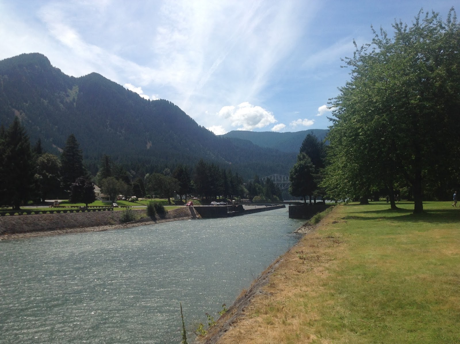
Before they built the nearby dam in the Columbia River, the river in the area of Cascade Locks was a rapids which meant that settlers coming down the river had to get off their boats and portage around the rapids. Some of the early settlers remained in the area thus making the present day town of Cascade Locks one of the oldest settlements on the Columbia River, established in 1853.  The locks that allowed the sternwheeler boats to avoid the rapids were constructed beginning in the 1880s and they were used to bypass the rapids until a dam was built in 1928 that blocked off further boat access to the west. Our campground overlooked these historic locks and Thunder Island that separated the locks from the river. We could also see from our campsite the magnificent Columbia River. This area now is all a public park which made it a perfect place to "camp" for the next four nights. The photograph on the above left is looking west down the old locks. On the left of the locks is our campsite; on the right is Thunder Island and in the distance is the Bridge of the Gods that passes over the Columbia River to Washington State.

The photograph to the right was taken from our campsite looking across the old Cascade Locks onto Thunder Island.  In the distance beyond Thunder Island is the Columbia River.  This is going to be a hard place to leave come next Saturday morning.

Joan's plan for us today was that we would drive west down the Columbia River on Hwy 30, also called the Historic Columbia River Highway, that was constructed beginning in 1915. The highway is winding and narrow and has long ago been replaced by I-84 as the rapid means of transportation.  This historic highway however, is the only way to drive down the gorge if speed is not the main motivator of the drive.  The historic highway provides the easiest route to access the many waterfalls and spectacular views along this Columbia Gorge.

We visited a number of waterfalls today including the Horsetail Falls shown in the photograph to the left.  One of the difficulties of photographing tall waterfalls is getting them to fit in one photo without standing far away.  Horsetail is 176 feet tall and it does not all show in this photo.  Consequently, Kathy and Joan are barely visible in the bottom of this picture.

Another beautiful and much taller waterfalls that we visited is the Multnomah Falls which drops 542 feet.  Unlike at the Horsetail Falls where the falls can be viewed almost at street level, the best vantage point to view the Multnomah Falls is from a bridge which is shown in this photo to the left.  To reach the bridge requires an uphill climb that was not too difficult even for this old man.  We did visit two more waterfalls after leaving Multnomah and I am sorry to admit that on one of them I gave up trying to hike to the base of the falls. Let us just say that I was just all warn out from all of the beauty. It had nothing to do with having to hike up a steep hill for a 1/4 of a mile.  


Kathy's best waterfall was undoubtedly the Multnomah Falls and I doubt it had anything to do with the high class gift store that she found at the base of the falls.  The bag in her hand and the grin on her face as she exited the store probably was just her showing her excitement at viewing the falls.  Right?


I wanted to include this one photo of the Columbia River Historic Highway since as they say, a picture is worth a thousand words.  That said however, I must admit that even this photo does not due this highway the justice that it deserves as one of the most picturesque highways I have ever been on. Just think of a narrow road with tree covered rocky cliffs on one side and a view through the woods of the far below Columbia River on the other side.  Wow!


At the end of the highway we came to a promenade with a building (with a gift store of course) and a parking lot. Here we were presented with breathtaking views of the Columbia River Gorge looking both east and west.  Almost everywhere along the Columbia River the views are beautiful but here from this highpoint, "majestic" is not enough to say.  I have included views both east and west from this vantage point as well as a view of the building which is appropriately named the Vista House which was built along with the historic highway and completed in 1918.


Looking west down the Columbia River towards Portland about 15 miles away.


Photo of Joan in front of Vista House.


We returned from our trip west down the Historic Columbia River Highway by mid-afternoon and the first thing that I suggested to our weary travelers when we returned back to our campsite is that we should walk down the street to the Thunder Island Brewing Co. and have a taste of one of their fine locally brewed ales. This we did along with the two dogs Cabo and Bodhi and together we sat at one of their outdoor tables, sipped beer, and watched the boats go by out in the great Columbia River. It is said that Lewis and Clark sat at this same location and sipped on beers on their famous adventure way back in 1815.  Frankly, I think someone may be lying about this but who knows. They would have been here in any case had they known how good the cold beer tasted.

In honor of Lewis and Clark who along with the many fine settlers who came to this part of the country down the Oregon Trail, we are going to add this one last photo in our blog today.  The photo shows two very weary travelers alongside a statue of a rather hot looking Sacajawea, guide to Lewis and Clark (beer lovers), that stands near a restaurant only a short walk from our camping site.  On this note we are going to end this one day blog.  Tomorrow we plan to drive down the north side of the Columbia River in the State of Washington.  Should be interesting.

Friday, July 17, 2015

Chapter 26 - Smiling River Campground to Cascade Locks

Monday, July 13th:
This is already our third full day at the Smiling River Campground on the Metolius River near Camp Sherman, Oregon and we are again ready for a wonderful day of exploring the Cascade Mountains of Central Oregon. Today Joan has planned for us two major new experiences.  The first is a trip to the Dee Wright Observatory in the Willamette National Forest. The observatory is located at the McKenzie Pass on Hwy 242 about 15 miles southwest of Sisters at an elevation of 5,325 feet above sea level. Our second experience will be a visit to a McKenzie river falls known as the Sahalie Falls.

Before we do anything this morning however, Kathy wanted to visit the small general store at Camp Sherman located just a few miles from our own Smiling River Campground.  The store was charming and just loaded with all kinds of supplies that might be needed by campers like ourselves including souvenirs. Naturally, souvenirs were the objects of Kathy's quest into this store and it is not surprising that her quest was successful.  More stuff to return back with us to Florida.


Our drive down to the Dee Wright Observatory took us a little under one hour not so much because it was far from our campground but because the road, Hwy 242, up to the McKenzie Pass where it was located, was a narrow winding two lane road that from our campsite climbed about 2,300 feet.  As we neared the top, the landscape changed dramatically from evergreen covered mountain sides to barren volcanic rock.  It appeared almost as if someone had piled huge boulders of rock alongside the road.  This was a sight like nothing we had ever seen. What we find unbelievable about this road is that it basically followed an old Indian trail that by the late 1800s actually became a highway and as early as the 1850s, some of the Oregon Trail settlers tried to cross the mountain pass in an attempt to shortcut the route to the Willamette Valley.

The view from the Dee Wright Observatory is incredible with views of the Three Sister Mountains to the east and Mt Washington to the north. This photo of Kathy shows the Dee Observatory in the background with Kathy pointing at the vast landscaping of rocks and the mountains in the distance. Three items of note: the observatory was built of volcanic rock way back in 1934-35 by the Civilian Conservation Corps, Oregon Route 242 is listed on the National Register of Historic Places (understandably), and Route 242 is closed all winter long sometimes until July due to the normal heavy snows in the area.


We love this photograph of Kathy and I and of course Cabo with North Sister Mountain in the background.  One thing that naturally does not show in this photograph is the wind and the 60 degree temperature and while we loved our walk on the trail through the volcanic rocks at McKenzie Pass, we were also happy to get back in the car, warm up a bit, and head on to Sahalie Falls.

You may recall in one of our previous posts, that we mentioned that we followed the McKenzie River when we drove along Hwy 126 on the way to our Smiling River Campground. As it turns out we actually drove past the entrance to the falls parking area.  Sahalie Falls is a lovely sight with a torrent of water plunging 100 feet into the rapids below creating a rainbow that unfortunately we did not capture in this photograph of Kathy and I at the viewing point near the top of the falls.


This goofy selfie (my first ever) clearly shows besides a balding old man, the rapids at the base of the falls. The falls and the rapids was a beautiful sight on this sunny and cool day and a great way to end our tourist activities on this Monday afternoon, our last day here in Central Oregon.  Tomorrow will be another interesting experience as we head for Oregon's famous Columbia River gorge.


Tuesday, July 14th:
Today we head north on a drive of approximately 180 miles that should take us approximately four hours. The highlight of the drive is clearly our drive past Oregon's tallest mountain, Mt Hood, that rises to a height of around 11,200 feet.  At best we can determine the road that we follow north, Hwy 26, passes very close to the base of Mt Hood where we traverse a pass at an elevation of about 3,950 feet.  What we discovered as we traveled north was that we could see the top of Mt Hood for almost an hour before we actually passed it on our west side.  Kathy took this photo of Mt Hood from our car maybe 20 miles or so before we actually passed the mountain.  It was obviously the highlight of our drive north this morning.

Our campsite for the next four nights is called the Cascade Locks Marine Park Campground and we had no idea of what to expect other than the campground was small and in the city of Cascade Parks.  As it turned out the park was in an incredibly beautiful location right by the old historic Cascade Locks that sit directly alongside the Columbia River.  We were directly within the Columbia River Gorge with tall and very steep mountains rising above us to our front and to our rear.  Just downriver from us was the massive Bridge to the Gods that crosses from Oregon to Washington. Upstream from us was the docking area for one of the Columbia River's many paddleboat cruise ships. The campground was close to shopping and close to many of the famous gorge water falls and historic trails that Joan has planned for us to visit over the next few days.  It was a perfect setting as you will soon see.