Friday, July 31, 2015

Chapter 35 - Billings to Buffalo, Wyoming

Thursday, July 30:
Our drive from Billings down to Buffalo, Wyoming was entirely on our interstate highway system which is remarkable considering that over the course of this almost 170 mile drive there was little traffic, we passed through remote and scarcely populated areas, and about a third of the drive was through the Crow Indian Reservation.  What a great country we live in where our federal government would build a divided highway system through miles of almost empty land (excluding cows) to get to a city like Buffalo with a population of under 6,000.  And I am definitely not complaining and here again the scenery on the drive today was beautiful. It is going to be hard to return to the east.

Believe it or not the local history books tell us that Buffalo, Wyoming was named not after the thousands of bisons that used to roam the area, but after the City of Buffalo, New York.  I am sure that it had nothing to do with the fact that Buffalo, WY and Buffalo, NY are both serviced by I-90, nor does it have anything to do with the fact that I was born in Buffalo, NY.  What we are told was that the name Buffalo was simply drawn from a list of possible names placed in a hat.  Pure luck as the case may be.

After Kathy and I were all hooked up in the Indian Campground and RV Park in Buffalo we decided to drive downtown to learn a little about the city where we had chosen to stay for the next two nights.  Incidentally, it is probably not politically correct to refer to Indians as "Indians" rather than Native Americans.  Furthermore, referring to bison as buffalo is genetically not correct as bison are native to North American whereas Buffalo are native to Africa and Asia. I suppose far more important than these two corrections is the observation that by the mid-1800s, Americans tried to slaughter all of the "Native Americans" and the "Bison" and now that many years have past, we are attempting to make amends by changing a few words to make up for our past indiscretions.  This is completely stupid but we certainly cannot blame Buffalo, Wyoming despite the fact that it was founded shortly after battles such as the Battle of Little Big Horn where Lt. Colonel George A. Custer and 263 soldiers were killed by Indians in 1876.

The historic downtown area of Buffalo, Wyoming is only two blocks long and by far the most historically important building in the area is the Occidental Hotel that was first constructed as a log structure in 1880. Although the original structure obviously has not survived, the current structure built in the early 1900s is still a hotel today and it is shown in the photograph above.  The photograph to the left shows us siting at the "saloon" in the hotel which while renovated as was the hotel in the 1990s, still is about as authentically old looking as any place we have ever visited.  Incidentally, Cabo did not have a beer although one was offered.

According to the hotel brochures some of its famous early visitors included Buffalo Bill Cody, Teddy Roosevelt, Calamity Jane, and Butch Cassidy and the Sundance Kid. We are hoping that they will soon add our names to their listing of historical visitors, at least to their saloon.  This photograph to the right was taken in the main lobby area of the hotel.

Most of the other buildings on Buffalo's Main Street were also fairly old, however none of the stores within the buildings offered anything as interesting as the Occidental Hotel.  Furthermore, most of the tourist brochures describing visitor options in the Buffalo area describe the beauty of the surrounding area particularly scenic drives up into the Big Horn Mountains immediate to the west of the city. Kathy and I decided that tomorrow we will drive out and see for ourselves the "spectacular scenery at every turn."

Friday, July 31st:
The southern portion of the 1.1 million acre Bighorn National Forest is immediately to the west of Buffalo, Wyoming and today one of the things that we wanted to do was to drive out U.S. 16 West, a highway they are calling the Cloud Peak Scenic Highway, and have a look for ourselves at the Bighorn Mountain Range.  We drove the highway approximately 25 miles before deciding to return to Buffalo as we had no particular destination in mind other than to checkout the beauty of Bighorn. The views for the entire drive were spectacular and we took many photographs.

This scene to the right was very typical of our short range scenery which consisted of numerous rock outcroppings, grass fields,and evergreen forests.  The photograph with Kathy and Cabo above shows one of our typical long range views of mountains ranging up to 7,000 feet and a few with snow still near their peaks.  One of the nicest things about all State and Federal parks including the Bighorn National Forest is the total lack of billboards other than the occasional historical or informational signs.


One fun thing that we did find in this particular national forest is this old wagon which we photographed. Kathy insisted that I be in the photograph rather than herself (with Cabo of course) although she admitted later that she did not want to "walk through the rattlesnake infested grass to get to the wagon." Obviously she had no qualms with me walking through the rattlesnake infested grass.


When we returned to Buffalo we decided that we would drive northwest of the city to an area at the edge of the Bighorn Mountains named the Bud Love Wildlife Habitat Management where their literature promised that we were guaranteed to see "big game species" at least during the winter months.  We were "game" for anything.  The drive this time was around 15 miles with the final section of the drive on very dusty gravel road.  The photo to the right shows Kathy pointing at the bullet dents in the sign apparently made by a former visitor upset because he failed to see any big game.


We also did not see any big game although we did see this scene of two White Tail adult deer (perhaps parents) walking across a field with two younger deer (perhaps their children). In the background is a very interesting stone house set on the top of a hill. In the near distance is the Bighorn Mountain range.  Here again the photograph is a poor substitute for the real thing that unfortunately only lasted for less than a minute.

We returned to our campsite by the early afternoon content once again on relaxing and preparing for our next day which was a drive to the Mt. Rushmore KOA located about 9 miles east of Mt Rushmore located in the Black Hills of South Dakota. 

I did take this final photograph in our campsite of a few of the children who were staying with their parents in the camper across the street from our own travel trailer. The kids were practicing roping a small metal model of a calf.  This weekend in Buffalo, Wyoming is the conclusion of the Johnson County Fair and Rodeo Week and these young kids were practicing for the calf roping contest for young folks their own age.  We left the next morning before asking how they performed in the competition.  I am sure that they had fun in any case.

Wednesday, July 29, 2015

Chapter 34 - Gardiner to Billings, Montana

Tuesday, July 28th:
We decided this morning to take the easy way out and head north away from Yellowstone. While we have yet to cancel our reservations in Cody, Wyoming or for that matter make new reservations somewhere around Billings, Montana, we just thought that attempting to pull our travel trailer through Yellowstone was not the safest thing to do.  As we drove north back towards I-90, Kathy took this photo of the local mountains. Considering the cold temperatures last night we were not surprised to see snow on their tops. Two days ago when we followed this same road south there was no snow. There is probably snow up in the mountains of Yellowstone as well and considering that we are Florida folks, snow on a summer vacation just does not make any sense, so we are running away (just kidding, we are driving away).

We called from a Rest Stop and made reservations at the Billings KOA. They claimed in their online literature that they were the first ever KOA and that they were established back in 1962.  Hope that does not mean that everything in their park is over 50 years old.  We arrived in Billings around noon and were delighted to find everything at the KOA looked very much up to date. 

Our space was well shaded and across the street from where we parked was the Yellowstone River with rock bluffs rising straight up from the river on its other side. It is pretty hard to find a prettier location. On another positive side, the weather here in Billings is sunny and the mid-afternoon temperatures are in the mid-70s.  We decided that for the remainder of the day other than going out for supplies, we would delay being tourists until tomorrow.  Billings is the largest city in Montana having a population of around 167,000, and considering our last minute decision to visit Billings and the largeness of the area, we thought it best that we do a little research first and decide what we wanted to visit, before we charge out into the city.

Wednesday, July 29th:
Both Kathy and I and Cabo as well, had a great sleep last night and we arose when it was already light outside at around 5:30 am.  It is amazing that after so many years of sleeping in a cushy king size bed, that we could become comfortable sleeping on a rather hard queen size bed that every time one of us rolls over the whole trailer rocks slightly. Try sleeping when the wind is blowing hard and the trailer rocks in the wind like a boat in the water.  I suppose that when we consider the conditions facing the early Oregon Trail travelers, we got it made (although they weren't paying $40 plus a night for a campground space.)


Our visit to Billings began at 8:30 am this morning when we drove to a park located on a high bluff above the city and I took this photo of Kathy and Cabo. The bluff was almost at a level elevation for at least three miles and it offered drivers numerous places to pull over and take photos or just enjoy the incredible views.

Our next adventure was a visit to the Pictograph Cave State Park that was located about five miles to the south of Billings down a winding up and down hilly road. The scenery consisted of dried grass pasture lands with lots of rocks and high rocky cliffs like the one in this photograph of Kathy and Cabo standing under the entrance sign into the park. The caves can be reached after a short hike and they contain on their walls ancient Indian paintings known as pictographs said to be upwards of 2,000 years old.  Archeologists began excavating in the caves back in 1937 and since then they have uncovered thousands of artifacts including animal remains thought to be the byproducts of human consumption (meaning food waste.)

This photo of Kathy in one of the caves shows her studying the walls looking for the faint pictograph markings.  The pictographs which were hard enough to see in person unfortunately do not show in this photograph. Considering that the markings show up at all is remarkable considering their age.


If one excludes the historical significance of the Pictograph Cave State Park, the incredible beauty of the area itself is enough to demand that anyone visiting Billings must come and view this place.  The photograph of Kathy and Cabo above displays some of the beauty but it also shows Kathy studying a sign that warns of rattlesnakes.  For a few minutes she actually refused to proceed but fortunately she changed her mind.  Cabo naturally demanded that he be carried.

It seems that many cities in The West have their own Boothill cemeteries and Billings, Montana is no exception. It was a must visit for us, although Garmin had trouble finding it and there were no local signs pointing to its location.  Fortunately Kathy spotted it up on a hill so we parked and made a brief climb.  Unfortunately all of the original grave markings were (long) gone, they were probably mostly constructed of wood in any case, and all that remained were a few more recent structures like the one that Kathy and Cabo are studying in the photograph.  It was still a fun visit and of course it gave us a chance to see additional areas around Billings.

Incidentally, speaking of Lewis and Clark . . . on their return voyage back east in 1806 they passed through the Billings area traveling along the Yellowstone River.  I suppose it is remotely possible that they may have even camped on the site of the Billings KOA.  One has to wonder such things being a history buff.

Our last tourist activity today was a visit to downtown Billings.  Frankly, and I have stated this before, I do not really like to visit large downtown areas but Billings came as quite a pleasant surprise.  For one thing, it was not at all crowded both in the streets or on the sidewalks.  This was not good for the stores but it sure was good for us.  Furthermore, we found a prime parking spot right on the main street and all it cost was 25 cents per half hour.  Like a few of the other western towns that we have visited there are colorful hanging potted plants down the streets, there are shade trees, and here in Billings at the major cross streets there was a huge canopy that completely covered the intersection.  The canopy shows in the adjacent photograph.


One of our destinations downtown was a Native American Nations store that sold all kinds of mostly handmade Indian articles from jewelry, to headdresses, to carvings, and even arrows.  Kathy, Cabo, and I spent quite a bit of time in the store although we were viewing it more like we were visiting a Native American museum instead of a store much to the chagrin of the store owners.  We were probably not alone in this regard.

We ended our visit to downtown Billings with a stop at a local coffee shop where we sat down and enjoyed our drinks at an outside table where we could watch the goings on in this very pretty downtown setting.  Who would have though.  Maybe I am just mellowing in my old age? 


On our way back to our campground, Kathy spotted some horses close by the highway so we quickly stopped (in the middle of the highway) and I took this photo (fortunately before a car hit us from behind).  I must admit that finding such a setting near our home in Estero, Florida would be impossible.  What a country.

Tomorrow morning we head down south again to a small town known as Buffalo, Wyoming.  Another new experience in this third month of our trip across America.


Tuesday, July 28, 2015

Chapter 33 - Butte to Gardiner, Montana

Sunday, July 26th:
Today marks the start of our third month on the road and today we leave for Gardiner, Montana. Gardiner is a town that we had never heard of until recently but because Gardiner sits at the north entrance to the Yellowstone National Park, it is mobbed with tourists during the summer months. We were lucky to get reservations at the Rocky Mountain RV Park especially since this park sits on a ridge above the city and above the entrance to Yellowstone. This photo was taken from the RV park. The mountains in the distance are in the Yellowstone National Park and the river in the foreground is the Yellowstone River.

The drive today was just under four hours but here again most of our drive was on the interstate and we arrived at our new campsite around 11:30 am relaxed and excited about visiting the famous Yellowstone National Park.  This afternoon we want to drive into the park just to "get our feet wet" so to speak and at least visit the Mammoth Hot Springs area which is only around eight miles from the north entrance. We provided a map of the park above so that we can better explain the areas we plan to visit. Tomorrow we will drive the entire park or at least the "figure-8" road shown on the above map.  The total distance is around 150 miles and it will probably take us the better part of Tuesday.  On Wednesday we will again enter the park but this time towing our travel trailer and we will exit the park at the East Entrance towards Cody, Wyoming.

Our drive into the park (after showing our new Senior Lifetime Pass) was up a steep winding road that followed in part the Yellowstone River and some steep mountain cliffs.  My immediate thought as we traversed this mountain road was will my poor Dodge Grand Caravan be able to tow our travel trailer up this mountain on Tuesday.  Stay tuned for the answer in a later blog.  Anyway, after driving the eight miles uphill we arrived at Mammoth Hot Springs, a highly developed commercial area complete with a large hotel, stores, and even a gas station.  Furthermore the place was crowded with people and no place to park.  What surprised us even more was that alongside the road were several dozen wild elk eating grass and seemingly oblivious to the traffic and numerous tourists with cameras.  A nearby sign warned that the elk were dangerous but they sure did not give that appearance.

We drove past the commercial area hoping to view some of the nearby hot springs that have made this part of Yellowstone famous. Within a matter of minutes we began to see what looked like smoke or steam rising from the ground both on our right and our left.  It was almost as if the ground were on fire. The steam of course was from the hot water bubbling up from the ground reacting to the cool air at the surface. At the same time the hot water reacts with the area's limestone bedrock, dissolving it in part and creating in the process carbon dioxide which in turn is released into the air. We read that this release into the air is kind of like what happens if you shake a carbonated soda and then remove the top of the bottle. You get the idea. In any case, the vision of what appears to be the ground on fire is quite an experience.

As we stated the hot water also causes the limestone rock at the surface to partially dissolve which when combined with the water then flows down the slopes giving the odd illusion of melting or frozen ice.  The hot solution also kills most of the vegetation in its path.  This photograph shows a good example of the end result appearance.  After spending several hours in the area of Mammoth Hot Springs, we decided to return to our campground, relax, and get ready for tomorrow's adventure again into Yellowstone National Park.

Monday, July 27th:
We arose even earlier than usual today both because of our eagerness to see Yellowstone but also because we felt that it was important to get to the park entrance early to avoid the long line that we had encountered on Sunday. It worked; we were into the Park without delay shortly before 7:30 am. Our first goal this morning is to go visit Old Faithful located about 58 miles south of the north entrance. Well, between the quantity of cars and the road construction the drive south to Old Faithful took us a little over two hours mostly nonstop.  We did have one delay however, that was delightful.  Cars were stopped in both directions because one big old bison decided to walk right down the road.  I took this photo as he passed by our stopped car; I could have almost reached out and touched him. He looked angry. Perhaps he too was upset by all of the cars.


We arrived at Old Faithful around 9:45 am and parked in a huge parking lot filled with what seemed like a million cars.  Obviously Old Faithful is the most popular feature in Yellowstone and the crowds in mid-summer certainly reflect that fact. We stopped in a large shopping center by the parking lot to get directions and a brochure and there we learned that Old Faithful had erupted only a few minutes earlier and we had a wait about one hour before the next eruption. From what I read during our wait, the frequency of Old Faithful's eruptions range between 45 to 125 minutes, the boiling water rises to an average of 145 feet, and the eruption lasts between 1-1/2 to 5 minutes.  We were excited and despite the rather chilly winds, we enjoyed sitting and watching the crowds of people gathering to wait for the show to start.  Unfortunately, dogs were not allowed to enter the close up area, so we found a nearby bench, sat down, and discussed how excited we were.  I took this photo around the peak of the eruption.  It lasted around two minutes but it was worth the wait.  Cabo slept throughout the entire show.

We left the Old Faithful area around 11 am and continued on the highway that at this point had turned east headed directly for Yellowstone Lake. Once again we ran into a delay caused by highway renovations.  Kathy was convinced that all of the road renovation work was due to the fact that next year is the 100th anniversary of the National Park Service and their first national park was Yellowstone that was established back in 1872.  Right or wrong, the park service was sure doing a lot of work on their road system.  Even considering the slow driving conditions, the incredible and diverse scenery offset any frustrations caused by the driving delays. Our road followed Lake Yellowstone for 20 to 30 miles and we were not at all surprised to read that Yellowstone Lake is the largest freshwater lake in North America at an elevation of over 7,000 feet.  The lake measures approximately 10 miles wide and up to 30 miles long. Frankly I was a bit chilly when Kathy took this photograph.


One of the enjoyable parts of driving through Yellowstone National Park is the ever changing scenery.  So far in our drive we have seen hot springs, geysers, lakes, the rapids of the Yellowstone River and the beauty of Yellowstone Lake, steep mountain cliffs, and elk and bison up close. We have even crossed the Continental Divide three times, our highest point being at Dunraven Pass at 8,859 feet above sea level during our last leg of todays drive.  Fortunately during this last leg of our drive the traffic was less so that we had more chances to pull over, find a parking space, and take more photographs of the spectacular scenery such as this one of Kathy and Cabo at the gorge below Tower Falls.

We knew that the weather today was suppose to turn much cooler with rain expected by the end of the day. We also faced high wind conditions as our highway again turned west headed back towards Mammoth Hot Springs.  This photo of Cabo and Kathy was taken probably at an elevation of around 7,500 feet with a temperature in the low 50s, and winds at least 30 mph.  Once the photo was taken Kathy rushed back into the car. One feature of the mountain sides that we could not help but notice and does show in this photo, is the end result of past forest fires with the diminished size and quantity of trees.

We are going to include this one last photo that we took inside the Park mostly because it again shows the many surprising sights that we encountered during our drive today. We were unable to learn exactly what we were witnessing.  At first we thought that the wagon was just a tourist ride but when we looked closer it was clear that all of the riders were dressed in clothes that might have been worn by early settlers in the mid-1800s.  Perhaps we had just let our imaginations run wild.  Maybe these really were just settlers looking for a Yellowstone campground for the night. I wonder if they know that most of the campgrounds are full.

This final photograph was taken of our travel trailer in our campground in Gardiner, Montana.  The photo was taken on Sunday afternoon.  By Monday evening however, the skies had darkened, the temperatures had dropped to the high 40s, and rain started falling by 6 pm.  By mid-night the temperatures fell into the high 30s.  Perhaps it was this ugly turn of the weather that made us rethink again about our plans for the next day.  Perhaps hauling our travel trailer up into the heights of Yellowstone National Park might be just too much for our car. We will decide what to do tomorrow morning assuming that we survive the cold wet weather in these mountains of southern Montana.
     

Sunday, July 26, 2015

Chapter 32 - Missoula to Butte, Montana

Friday, July 24th: 
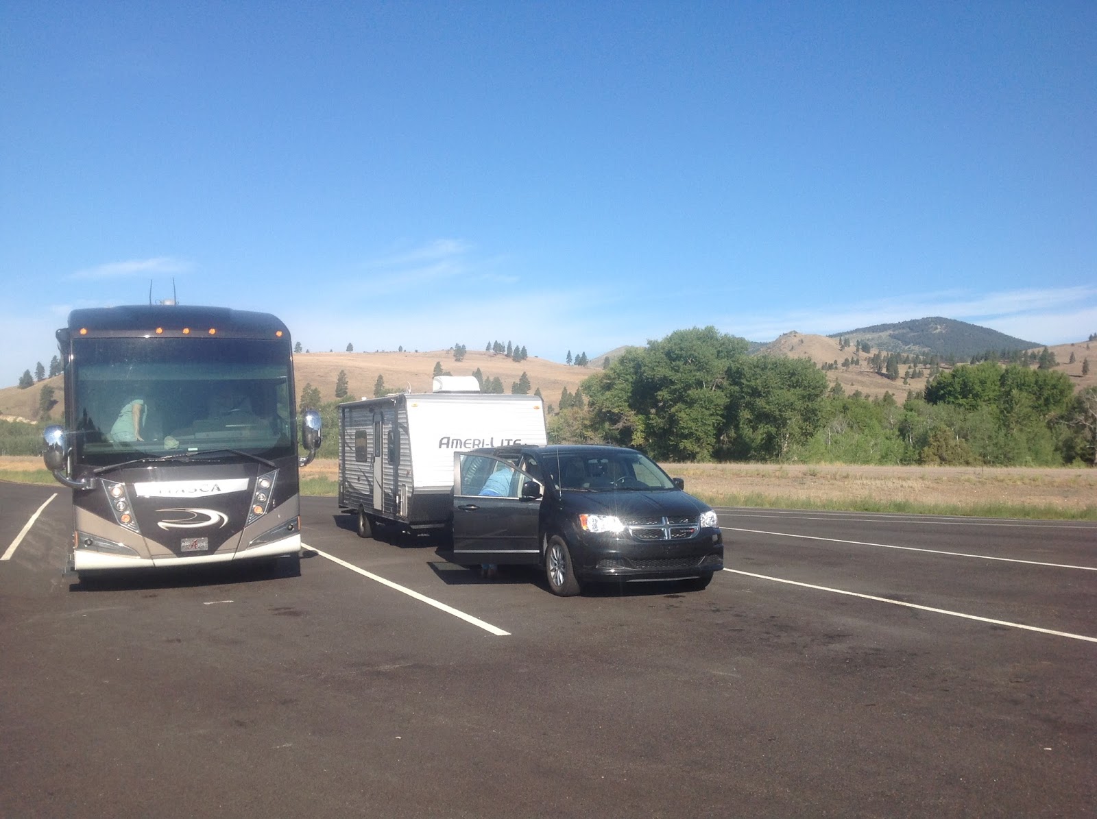
The 2-1/2 hour drive down to Butte, Montana was easy and enjoyable.  Not only were we driving again on the interstate system, I-90 in this case, but the traffic was light, we were in no hurry, and as always out here in the western mountains, the scenery was beautiful.  The City of Butte was not one of our originally planned stops but as any seasoned RVer knows, sometimes when you call ahead to make your reservation for the following night, the campground is full. Rather than spending several days in Bozeman as we had planned, we ended up a bit further north, although perhaps in our favor as the City of Butte, Montana might very well be a very interesting place to visit.  We thought you might enjoy this photo taken at a rest stop that shows little brother next to big brother.  We have finally gotten used to be the smallest and we are no longer intimidated.


Unfortunately our second choice for an RV park proved to have a few deficiencies. Not only did we not have a sewer hookup (I know, we have become spoiled), but also our particular space within the park could not pickup the internet. If I wanted to go online I needed to go over to the other side of the park where the WiFi signal was stronger. Even considering these two negatives, the park was attractive and its location was close by the city of Butte.  We knew nothing about Butte before this visit but once we parked our travel trailer and we could see off in the distance on a large hill the entire city, we knew that this might be quite an educational experience.

What we could see in the distance above the city was what looked like oil wells. We learned soon later that they were not oil wells but the tops of old copper mine towers called "Headframes," that contained wheels at their tops to lower the miners, mules, equipment, and supplies down into the deep mine shafts.  From what we read there were 14 of these old black steel towers in the city and we knew immediately that at least one of our stops in Butte had to be at an old headframe.


Butte's began as a mining town in the late 1800s and although copper became the dominant mineral pulled out of the ground, gold and silver mining started in the area as far back as the early 1860s.  It was copper however, that made the city famous and gave it the title of "The Richest Hill on Earth."

In 1882, 9 million pounds of copper were removed from the ground.  A year later production increased by 250% and then in 1896 the mines in Butte produced 210 million tons of copper or about 26% of the entire world supply and 51% of all copper mined in the United States. 

In 1890, the area around Butte had around 24,000 people.  By 1920 in the peak period of the mining the population had increased to 100,000. After World War I copper prices started falling and by the mid-1980s copper mining had all but ceased to exist. The city's history is woven around the copper mining industry and it should not be surprising that much of Butte's current tourist industry revolves around mining.  The above photographs show Kathy and Cabo at the entrance of the closed Berkeley Pit and at the viewing platform that allows visitors to view the largest open copper mining pit in the city.


We ended our afternoon by driving to one of the highest points above the city to check out the view of the city down below and take the above photograph.  Tomorrow we plan to further explore the copper mining industry and check out the downtown area of Butte.  Incidentally the City of Butte refers to the downtown area on all street signs as "Uptown" for obvious reasons.  We did learn that one happening this weekend in Butte explains why our  RV park was full and why some of the streets in the updown area are closed. This weekend in Butte is "Evil Knievel Days."  As it turns out Robert Craig "Evel" Knievel was born and raised in Butte and this weekends festival is likely to draw 50,000 visitors to the city.  Not good for us. Kathy made me sell my only motorcycle before we were married.

Saturday, July 25th:
When we walked around the RV park this morning we found that there were at least thirty or more motorcycles parked out in front of tents. It is doubtful that on any other weekend we would find any motorcycle campers but this particular weekend motorcyclists were everywhere.  Kathy said it reminded her of the old movie "Easy Rider" but all I could think of was a collection of aging hippies from the 1960s - not in a negative way of course. In any case, our plans were NOT to be downtown, excuse me, Updown, this afternoon. Crowds are no longer fun.

One of the many problems that helped lead to the eventually collapse of the copper mining industry in Butte was the horribly unsafe conditions deep down in the mines. In 1917 the worst hardrock mining disaster occurred in the United States at one of the Butte mines that took 168 lives.  The United States Bureau of Mines stepped in and created many of the safety laws and mine regulations still in affect today.  Kathy and I (and Cabo) visited a memorial to these 168 men who lost their lives.


One observation that we made that we knew was a direct result of the earlier mining industry was the number of older small homes in and around the area of the mining headframes.  Many of the residential buildings clearly were meant to house several or more families.  It seems apparent that these older homes many of which had been upgraded, were the homes of the miners. We also noted that the larger and fancier homes probably owned by the mine owners were closer to or in the uptown area. 


After our final inspection of Butte former mining days, we decided to venture "uptown" which in this case was down below us. It was still before noon.  The first activity that we encountered was an antique car show which seemed a bit odd as today was a celebration of motorcycles.  We walked by many of the antique cars before it suddenly occurred to me that many of the cars were twenty years or so younger than I am. Disturbing as was this observation, I was very pleased with the many old buildings (older than I am) that we passed by during our walk.


After passing through the antique car show we ended up on the next street below that was lined on both sides for two blocks with vendors selling everything from junk food to tee shirts and other Evel Knievel souvenirs.  It was completely maddening to think that any of these hundreds of vendors could make money on such junk considering so much competition. Here again though and it's perhaps my old contractor upbringing, but I loved the old buildings that lined both sides of the street.


Were it not for the anticipated crowds it might have been interesting to watch the motorcycle jumping that was scheduled for this afternoon and evening.  But since we had already decided not to attend these functions (and we later determined that Cabo was not invited), we decided to be satisfied with visiting a statue of Butte native son Robert Craig Knievel that was temporarily erected in the center of Butte's main uptown street.

We retuned back to our campground by early afternoon well satisfied with what we had seen in the City of Butte, Montana.  Tomorrow we head southeast to the town of Gardiner.  Our RV Park, the Rocky Mountain RV Park is situated about one mile from the north entrance to Yellowstone National Park.  Another one of our dreams is about to come true.


Thursday, July 23, 2015

Chapter 31 - Clarkston to Missoula, Montana

Wednesday, July 22nd:
The distance from our campsite in Clarkston, Washington to our new campsite in Missoula, Montana, the Missoula KOA, is 220 miles.  Almost the entire drive is on U.S. Route 12 through Idaho.  This road which was previously known as the Lewis and Clark Highway, and is now named the Northwest Passage Scenic Highway, has to be one of the top scenic highways in all of the United States. The highway follows for much of its length the Clearwater River and the Lochsa River, and then once we cross the Lolo Pass at 5,233 feet, the highest elevation of todays drive, we followed the West Fork Lolo Creek down into Missoula. The Lewis and Clark Expedition followed these rivers on their famous journey west back in 1805. Also interesting about this route is that a little over a third of the drive runs through the Nez Perse Indian Reservation.


No part of the drive however, is on a road that is straight or even level as the highway follows along the winding courses of the various rivers. Then depending on which direction you are traveling, in  our case east, the road rises against the rapidly falling river water that is running to the west ultimately to the Pacific Ocean. The photo of Kathy and Cabo that was taken when we briefly stopped to rest and let traffic pass us by, clearly shows the fast moving rapids of the Lochsa River.

Our total drive time with a few stops took us almost 5-1/2 hours which works out to an average speed of only 40 miles per hour.  While we were delighted with the spectacular scenery all along todays drive, the driving was also stressful and we were really ready to relax once we arrived at the Missoula KOA around 1:30 pm Mountain Time.  The remoteness in the area of Hwy 12 through Idaho is well illustrated by the fact that at one point the distance between gas stations was 90 miles.  Thanks to Miss Garmin, we purchased gas at the last station before the 90 mile void, which we welcomed, but it was undoubtedly the most primitive (1950s) gas station I have stopped at in fifty years and gas sold for $3.599 per gallon.  Ouch!

The KOA campground was large and by the end of the day mostly full, but our setting was very nice as we were under a shade tree plus we had full hookups including WiFi and cable TV and the temperatures were only in the high 70s.  Other than a quick trip over to a nearby Walmart we stayed "home" for the rest of the day.  Frankly, while we had not studied a list of tourist attractions here in Missoula, the size of the metropolitan area, population around 113,000, and the traffic that we encountered coming into the city did not leave us excited to go exploring after our long tiring drive.

Thursday, July 23rd:
One thing about changing time zones and losing an hour as we drove east, was that we slept in an extra hour (at least by my watch). Actually it was Cabo who alerted us to get up as he needed to find a tree or fire hydrant as soon as possible.  It was 6:30 am Mountain Time. I spent a few minutes during breakfast reviewing the various brochures that we had picked up when we registered at the campground office and after discussing the alternatives with Kathy, we decided to drive to downtown Missoula to see what they have to offer. Our first stop was at the St Francis Xavier Church which was built back in 1889. The church was actually easy to find as the downtown area was not large and the high steeple of the church was visible from several blocks away.


Fortunately the door of the church was wide open which is often the case with Catholic Churches. After Kathy spent time inside while I watched Cabo (it was unclear whether dogs could worship inside Catholic churches), I too visited the inside of what turned out to be an incredibly beautiful interior. While the stained glass windows were wonderful they were not entirely unique.  What was really special about the entire were the paintings on the walls and ceilings that we were told were painted by one of the brothers of the Society of Jesus who worked for the church as a kitchen worker. The photograph may not show it but this guy was a true Master, apparently with special gift from God. Fortunately his artwork is still shared with visitors more than a century later. 

Kathy, Cabo, and I walked around three or four blocks through the downtown Main streets.  What surprised us was the general quality of the stores and much like Walla Walla, the quality of the architecture of their exteriors.  There were lots of various art stores, book stores, specialty clothing stores, small restaurants, plus many others that in part undoubtedly attracted the many young college students that we watched walking the streets, undoubtedly from the nearby University of Montana. One of the many stores that we entered was this bookstore where they were pushing a new book on "The Oregon Trail."  The sales girl told us that the author of the book, Rinker Buck, was going to be in the store tonight to autograph his books.  Tempting, but I suspect we will not attend.  Besides, that is old hat; we are now on the Lewis and Clark Trail.

We spent about two hours downtown between visiting the church, walking in and out of stores, and walking past several of the public buildings including a large Missoula County Courthouse that shows in the photograph below. The photograph to the right was taken of Kathy looking at real estate listings here in Missoula. Unlike much of the real estate for sale in the coastal states, the selling prices for homes here in this area appears to be more reasonably priced, about 25% lower.


This last photo was taken of Kathy and Cabo in front of the Missoula Capital Courthouse.  After visiting the downtown area we drove out to the west side of the city to visit the Historical Museum of Fort Missoula.  Unfortunately and not unsurprisingly, Cabo was not allowed in the museum.  We were able however, to drive around the grounds and look at some of the historical structures that had been relocated to this large 32 acre park. Frankly, this museum and the grounds were not unlike some of the other similar historical museums that we have visited.  Cabo saved us the $12 entrance fee. Thanks Cabo.

Tomorrow we head for the Butte Montana KOA on the way to next weeks visit to Yellowstone National Park.