Wednesday, July 15th:
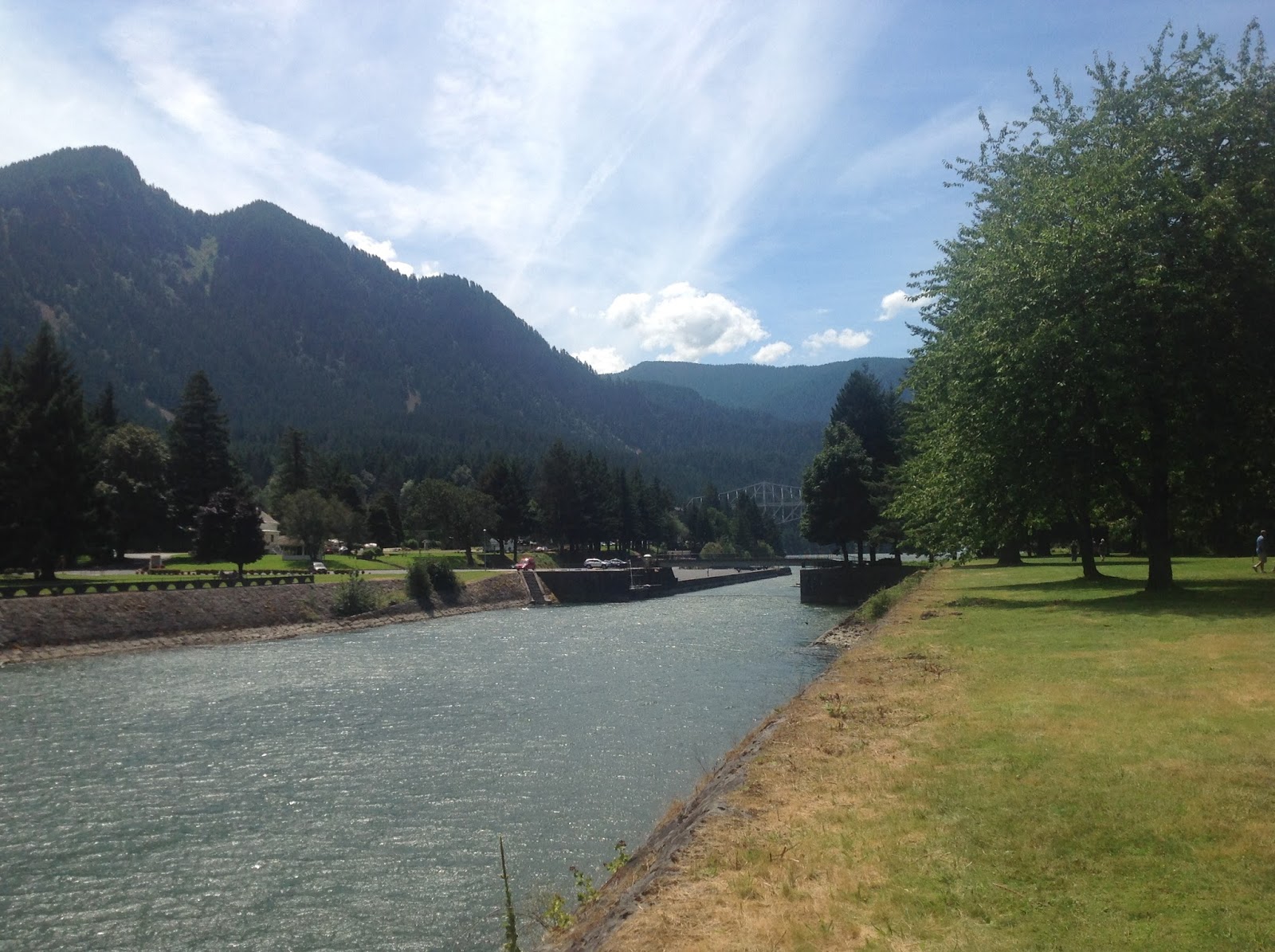
Before they built the nearby dam in the Columbia River, the river in the area of Cascade Locks was a rapids which meant that settlers coming down the river had to get off their boats and portage around the rapids. Some of the early settlers remained in the area thus making the present day town of Cascade Locks one of the oldest settlements on the Columbia River, established in 1853. The locks that allowed the sternwheeler boats to avoid the rapids were constructed beginning in the 1880s and they were used to bypass the rapids until a dam was built in 1928 that blocked off further boat access to the west. Our campground overlooked these historic locks and Thunder Island that separated the locks from the river. We could also see from our campsite the magnificent Columbia River. This area now is all a public park which made it a perfect place to "camp" for the next four nights. The photograph on the above left is looking west down the old locks. On the left of the locks is our campsite; on the right is Thunder Island and in the distance is the Bridge of the Gods that passes over the Columbia River to Washington State.

The photograph to the right was taken from our campsite looking across the old Cascade Locks onto Thunder Island. In the distance beyond Thunder Island is the Columbia River. This is going to be a hard place to leave come next Saturday morning.
Joan's plan for us today was that we would drive west down the Columbia River on Hwy 30, also called the Historic Columbia River Highway, that was constructed beginning in 1915. The highway is winding and narrow and has long ago been replaced by I-84 as the rapid means of transportation. This historic highway however, is the only way to drive down the gorge if speed is not the main motivator of the drive. The historic highway provides the easiest route to access the many waterfalls and spectacular views along this Columbia Gorge.
We visited a number of waterfalls today including the Horsetail Falls shown in the photograph to the left. One of the difficulties of photographing tall waterfalls is getting them to fit in one photo without standing far away. Horsetail is 176 feet tall and it does not all show in this photo. Consequently, Kathy and Joan are barely visible in the bottom of this picture.

Another beautiful and much taller waterfalls that we visited is the Multnomah Falls which drops 542 feet. Unlike at the Horsetail Falls where the falls can be viewed almost at street level, the best vantage point to view the Multnomah Falls is from a bridge which is shown in this photo to the left. To reach the bridge requires an uphill climb that was not too difficult even for this old man. We did visit two more waterfalls after leaving Multnomah and I am sorry to admit that on one of them I gave up trying to hike to the base of the falls. Let us just say that I was just all warn out from all of the beauty. It had nothing to do with having to hike up a steep hill for a 1/4 of a mile.
Kathy's best waterfall was undoubtedly the Multnomah Falls and I doubt it had anything to do with the high class gift store that she found at the base of the falls. The bag in her hand and the grin on her face as she exited the store probably was just her showing her excitement at viewing the falls. Right?
I wanted to include this one photo of the Columbia River Historic Highway since as they say, a picture is worth a thousand words. That said however, I must admit that even this photo does not due this highway the justice that it deserves as one of the most picturesque highways I have ever been on. Just think of a narrow road with tree covered rocky cliffs on one side and a view through the woods of the far below Columbia River on the other side. Wow!

At the end of the highway we came to a promenade with a building (with a gift store of course) and a parking lot. Here we were presented with breathtaking views of the Columbia River Gorge looking both east and west. Almost everywhere along the Columbia River the views are beautiful but here from this highpoint, "majestic" is not enough to say. I have included views both east and west from this vantage point as well as a view of the building which is appropriately named the Vista House which was built along with the historic highway and completed in 1918.
Looking west down the Columbia River towards Portland about 15 miles away.
Photo of Joan in front of Vista House.
We returned from our trip west down the Historic Columbia River Highway by mid-afternoon and the first thing that I suggested to our weary travelers when we returned back to our campsite is that we should walk down the street to the Thunder Island Brewing Co. and have a taste of one of their fine locally brewed ales. This we did along with the two dogs Cabo and Bodhi and together we sat at one of their outdoor tables, sipped beer, and watched the boats go by out in the great Columbia River. It is said that Lewis and Clark sat at this same location and sipped on beers on their famous adventure way back in 1815. Frankly, I think someone may be lying about this but who knows. They would have been here in any case had they known how good the cold beer tasted.

In honor of Lewis and Clark who along with the many fine settlers who came to this part of the country down the Oregon Trail, we are going to add this one last photo in our blog today. The photo shows two very weary travelers alongside a statue of a rather hot looking Sacajawea, guide to Lewis and Clark (beer lovers), that stands near a restaurant only a short walk from our camping site. On this note we are going to end this one day blog. Tomorrow we plan to drive down the north side of the Columbia River in the State of Washington. Should be interesting.


No comments:
Post a Comment