Monday, June 29, 2015

Chapter 19 - Toppenish to Issaquah, Washington (near Seattle)

Sunday, June 28th:
Today we drove 146 miles. The first 60 miles of our drive was through the same dry, rocky, hilly, and treeless countryside to which we had become accustomed. Unfortunately, at least for our car's transmission, much of the drive was uphill until we reached the Manastash Ridge at elevation 2,672 feet, about 1,900 feet above the elevation of our campsite on the Yatama Nation Indian Reservation and around 1,100 feet above the city of Ellensburg located just to the north of the ridge.  The view from the Manastash Ridge shown in the above photograph is looking down into the Yakima River Valley and the City of Ellenburg.  Off in the distance are Washington State's famous Cascades Mountains where we will cross today.


This topographical map of Washington State shows clearly the type of terrain through which we passed. Our drive began just south of Yakima shown in the lower center of the map along I-82. To the west of us both of which could be seen in the distance as we drove northwest, were the snow capped mountain peaks of Mt. Adams and Mt Rainier the two highest mountains in Washington. Just south of Ellensburg we connected with I-90 which we then followed across the Cascade Mountains to our final destination in the city of Issaquah located about 15 miles east of Seattle.  Incidentally, for those of you who live in the Boston area, did you know that you can drive all the way out to Seattle, Washington on I-90.  No maps needed, Just I-90.

Were in not for the incredible amount of traffic on I-90, the drive through the Cascade Mountains would have been the highlight so far of our entire trip to the West. While we obviously did not take the photograph to the right since it was taken far above our interstate highway, it does show clearly the type of scenery that we encountered during our 60 mile drive across these mountains. According to Wikipedia if it can be believed, an average of 27,087 vehicles (10,000 of which are trucks) pass through these mountains on an average day. Apparently the high volume of traffic may not slow down much in the winter since before the beginning of the uphill climb there were large pull-off areas along the interstate where drivers, particularly truckers, are provided the room to "Chain-Up". No way in the winter for us.

Kathy took this photograph just before we crossed through the Snoqualmie Pass at elevation 3,022 feet. Prior to reaching the pass we had climbed almost 1,500 feet, almost as much as we had climbed only a few hours earlier to reach the Manastask Ridge (oh, our poor transmission).  But transmission be damned! This drive through the Cascade Mountains was so spectacularly beautiful. Awe inspiring even. Once we crossed the Snoqualmie Pass it was all downhill, a distance to our campground of around 36 miles.  I never once in all that distance had to use the accelerator and only occasionally did I have to apply the breaks. The Interstate at this point was four lanes wide.  Let 'em ride.  A mad rush to the bottom. Incidentally, the nickname for the State of Washington is the Evergreen State. Our passage through the Cascade Mountains and into the Seattle area showed us why the state bears this name.  Pines, firs, and Hemlock trees covered the mountainsides everywhere but on the rocky, snow covered mountaintops.

We have see hundreds of different types of trailers and motorhomes on our trip west but his particular large and rather old Airstream motorhome has to be our best find yet.  It was occupied by a young couple with three young kids and from what we could tell they appeared to be having fun.


We arrived at our campground, the Issaquah Village RV Park, around 11 am and despite the still early hour we were both tired, in part because the drive itself can be tiring, but also because we cannot seem to break the habit of getting up early. This morning we were up and about just before 5 am. It was already light outside, it was cool for a change, and besides it was almost 8 am in Florida. We were ready to get on the road again and explore some more of our country. Unfortunately, when we arrived at the Issaquah Village RV Park we discovered that it was a bit of a disappointment. While it was fairly highly rated by "Good Sams," as you can see in the photograph it was very crowded and the spaces allowed for each unit were so small that we could not even put out our awning. Our little trailer was also a little intimidated having to look at such huge thugs on both of its sides. Furthermore Kathy and I were even slightly intimidated enough to kept our blinds closed for the rest of the afternoon and evening. Camping is not always in the great and wide outdoors. We joked that we might have better stayed in a wide open Walmart parking lot.  Just kidding!  Well, maybe not.

Monday, June 29th:
We made the huge mistake of again getting up early and then heading out to downtown Seattle by 8:30 am, just about the same time as the 660,000 residents of Seattle were all headed for work or play.  The traffic on the interstate was bumper to bumper for almost the entire 15 miles into downtown Seattle.  We knew immediately that no matter how beautiful we would find the city, the hustle and bustle of the roads and the city crowds would probably dampen our levels of pleasure. As it turned out, it was hard to enjoy Seattle. The parking was expensive and the downtown driving for this old man was just too much.

One thing that we had to do, if nothing else, was to visit Seattle's famous Space/Needle which was located downtown in an area known as Seattle Center. Fortunately we arrived at the parking lot before 9 am which meant that we got a real break on the parking fee as the cost was only $10 for early arrivals. Not a good start. It is also a good thing that Cabo was not allowed in the Needle ride to the top or we would have dropped another $44. On the other hand, the view of the Space/Needle was wonderful even from the ground level and the walk around the Seattle Center park was very pleasant.  We even stopped for a coffee and cookie at the local Starbucks and Cabo had a chance to lift his leg on some of Seattle's finer bushes (see photo below.)                  


This photo were taken in the park area around the Space/Needle where we spent the better part of our time visiting Seattle. After we left this area "Seattle Center," we spent about 45 minutes to an hour driving through the downtown area.


Our original plan was to stop at various sites such as the Pine Place Market and on Alaskan Way along the waterfront and Seattle's Great (Ferris)Wheel but with the crowded streets and parking we resolved that just driving through these areas was our best approach.  Perhaps if we were younger . . . , but then Kathy also made the observation that without Cabo we might have taken one of the local tour buses or trolley cars around the city that would have given us a more relaxed view of the city. In any case, we returned to our campground around lunchtime with the simple plan of just relaxing for the rest of the day. We have to admit that our visit to Seattle was not the best we might have expected. I think that after driving 4,500 miles and spending days mostly in smaller communities, we might have better spent several nights at a less crowded campground in a less crowded city and let just the wonders of the countryside satisfied our tourist needs.  Whatever, we can now at least brag that we have been to Seattle, Washington about as far as one can drive away from Estero, Florida in the United States without passing into Canada or Mexico.

Tomorrow we head for Portland. Perhaps we will spend less time within this also large city and spend more time exploring the Columbia River Gorge or the North Oregon coast line.  We shall see.


Saturday, June 27, 2015

Chapter 18 - Pendleton to Toppenish, Washington

Friday, June 26th:
As Kathy pointed out this morning, today is kind of special since we have been on the road exactly one month. We both agreed that it hardly seems that long as we are still having fun and still looking forward to tomorrow and the day after tomorrow. That is kind of special and we hope that the feeling will continue for many more days.  Our plan now is to go all the way to Seattle, Washington before returning to Oregon and spending time with my sister Joan.  Joan has planned a two week camping tour of Oregon and as Joan is a professional camper we are very much looking forward to what she has planned.

Today we are headed for a campground located just outside the city of Toppenish, Washington set in what is known as the Yakima River Valley. The scenery as we headed out of Pendleton was pretty much what we had grown accustomed to, but not long after we crossed the Columbia River on the Oregon/Washington state line and soon entered the Yakima River Valley near Benton City, Washington, the scenery dramatically changed. We had suddenly entered a major Washington State grape growing region and on both sides of the highway for miles were hundreds of acres of vineyards.  Here and there we drove by wineries some with buildings that looked like French chalets. In addition to the many vineyards there were also acres of apple, pear and cherry orchards as well as cornfields. Obviously we were entering a new phase of our trip westward.  The photo of Kathy and Cabo was taken in front of a tent within our new campground. Believe it or not the tent is a "Rental Unit."

Our campground for the next two nights is to be the Yakama Nation RV Resort which is located within the Yakama Indian Reservation and a few miles from the City of Toppenish which is also within the reservation. The Yakama Reservation is huge containing 1,130,000 acres and it was granted to the Yakama tribe by treaty way back in 1855. Today the population within the reservation is approximately 6,300 and not surprisingly almost everyone that we encountered both within the RV park offices, the nearby Indian cultural museum, the Casino, and in the stores in downtown Toppenish, were all of American Indian descent. While most of the homes in the area and in the city were not luxurious, it was still clear that the tribal residents were living comfortably.

The temperatures in the area when we arrived were already in the low 90s and they were expected to rise to the high 90s by mid-afternoon.  We both decided that it was better to confine ourselves to air conditioned space rather than playing an outdoor tourist role.  We did however, drive downtown to pickup a few supplies and then on the way "home" we stopped at the Yakama Nation Cultural Center where Kathy wanted to explore their gift shop. She must have figured that lots of culture can be found in gift stores. She quickly discovered that everything in their gift store was grossly overpriced so Kathy left empty-handed (much to my delight).

While we were downtown we looked everywhere for a bank or an ATM machine but without success. After we left the Cultural Center we decided to go over to the Yakama Legends Casino where we were convinced that they would have an ATM machine. Since Cabo was not allowed in the casino and the temperatures were much too hot to leave him alone in the car, I ran inside the casino by myself. The outside of the casino was not much to look at as the photo shows, although they are in the process of building a new addition to the casino and a large hotel next door. The inside however, was a lively and crowded typical casino.  Lots of noise, blinking lights, and cigarette smoke. I located the ATM immediately, requested $100, and to my surprise, out came a $100 bill from the machine. It has been years since I have touched or even seen a $100 bill, and I knew that outside of the casino a bill of this size is unwelcome at most stores. So I found the cashier and requested five twenties. She obliged, maybe thinking that I was a small time gambler.  I then hurried back out to the car and we returned to our cool tin box. We spent the rest of the afternoon relaxing to the roar of our overhead air conditioner and occasionally glancing at the outside lawn sprinkler that as it turned out continued to water the grass in front of our trailer all afternoon and then all night. The next morning I no longer felt sorry for the grass and I shut the sprinkler off without receiving the required permission from the tribal lawn caretakers.              

Saturday, June 27th:
This area is noted for a number of things, two of which we planned to explore today.  The City of Toppenish, population only 9,000, is noted for its wall murals that seem to cover most of the walls of the buildings in the downtown area.  There are now 75 murals in total and every June the city sponsors the painting of another mural.  These murals for their uniqueness, were a must see for us. Kathy was reminded of the number of theater sets that she has helped paint over the past dozen years, although some of these wall painting were very much larger than most typical theater stages.

We took at least a dozen photos of the different murals and it would serve no real purpose to include all of them in this blog. These two photos capture the beauty of the murals that in total seem to tell a pictorial history of the area.  Who would have ever expected to find such a wonderful outside display in an Indian reservation city in southwestern Washington State.  What a special surprise.

Our other must see are the hundreds of acres of vineyards located just to the east of the reservation. Since just looking at grape vines growing is a bit weak on its own, we naturally had to visit at least one of the dozens of wineries in the area and of course, visit their wine tasting room, taste the wine (of course), and then purchase at least one bottle of the local wine. This was going to be a great day. The vineyards covered the land for miles in every direction although here an there between the vineyards were apple, pear, and cherry orchards. Hard to imagine that we had never heard of the Yakima Valley until a few days ago.  What a country!

This photo shows some of the many acres of grape vines growing in the Yakima Valley.  Kathy and I drove for probably 45 minutes through the back roads of this wine grape growing area near a small town by the name of Zillah.  We must have driven by 15 or more wineries before we finally selected one to visit and taste their wines.


We chose as out winery to visit the Bonair Winery.  Our reasons for selecting this particular winery were purely speculative based almost entirely on the winery's location down a long gravel road surrounded by vineyards, plus we liked the look of the tasting building.  We did not regret our choice as their wine was excellent and we ended up purchasing two bottles, one dry white and one dry red.


The smile on the face of this happy wine buyer either means he is delighted with his purchases or he is a bit tipsy from sampling five different wines before noon, or, perhaps both.  

Tomorrow morning we are headed for Seattle.  What's next?

Friday, June 26, 2015

Chapter 17 - Boise to Pendleton, Oregon

Thursday, June 25th:
I know that we keep saying this, but today really was one of the best and most scenic drives that Kathy and I have ever experienced. As we left Boise behind, the land was soon just rugged and empty rolling hills.  This changed rather quickly into steep treeless hills where for awhile on the inclines in order not to overheat our car engine in the 90 plus degree temperatures, we were forced to reduce our speed down to only 40 mph.  As our elevation continued to increase we were surprised to see that the mountain sides were covered with evergreen trees. The only other green that we saw other than the evergreen trees was in the two or three locations where we crossed or drove along side the Snake River or the few other smaller creeks and rivers that flowed through the lower valleys.

The drive today was around 210 miles and including stops at two rest areas like the one shown in the photo to the right, we were on the road a little over four hours.  Perhaps it is my advancing age, but the stress of driving four hours pulling a trailer that is continuously swaying and tugging on the car, is very stressful and tiring.  Despite the beauty of the drive, both Kathy and I were happy to pull into the Pendleton/Mountain View KOA in Pendleton, Oregon.


This photo to the left is just one of many that Kathy took while we were driving up I-84 towards Pendleton. It clearly shows the size of the mountains that rose on both sides of the highway. What we found really remarkable is that the Oregon Trail passed through these same mountains and while the settlers would have known that they were nearing their final destination in Oregon, they must have been really tested to the point of exhaustion and sometimes even to the point of death.  Our trip out west has loosely followed the original Oregon Trail other than a few divergences such as out trip to the Grand Tetons.

Most of the trail while hardly easy for the wagon trains, it did not climb up into the steep Rocky Mountains.  For us to discover as we neared the end of the Oregon Trail, that these early settlers were now forced to cross through mountains came as quite a surprise. We assumed that things could only get easier as they crossed into the future state of Oregon. The elevation in Boise was only 2,704 feet above sea level.  While the early Oregon Trail wagon trains may not have all crossed through the same pass that we did on I-84, if they had they would have been as we were at an elevation of 4,193. This elevation change meant that as the settlers covered a distance of around 150 miles they also had to climb around 1,500 feet. It was hard enough in our car pulling a trailer; how about horses or steers pulling a loaded wagon with the settlers young and old walking next to their wagons.  Truly amazing.

As we have previously mentioned, the primary reason for choosing Pendleton as a stopover point was because of the world famous Pendleton Woolen Mills, maker among other things of woolen Indian blankets. Kathy already has a small collection of Pendleton made items so it was perfectly natural that she would want to visit the Pendleton factory, or more accurately, their gift shop.  After checking in at the Pendleton/Meridian KOA which we did at 11:00 am (we had gained an hour as we passed into the Pacific Coast time zone) and getting all hooked up, we headed for the Pendleton factory store. The photograph to the left shows Kathy coming out of the store with her bag of self-gifts or shall we say souvenirs of our trip to Oregon.


One of the "self-gifts," a hooded poncho in a beautiful Indian design pattern.

After visiting the Pendleton Woolen Mills, which incidentally has been in operation in Pendleton since 1909, we decided to drive around the city to see if we could find anything interesting in addition to also finding a local food market.  The City of Pendleton is kind of old fashion with a few quaint shops but other than this view of the city that we took from above the city, we did not explore the city in any depth. Our plan in any case was to spend only one night in Pendleton before moving on.

One of the interesting observations about Pendleton as well as all of the other cities we have visited as we traveled through the northwest, is that the cities are very similar to eastern cities except for one major thing: just 100 yards out of the cities we return again to dry and barren countryside. This photo to the right was taken from the edge of our RV park.  One would think that we were almost visiting the Sahara Desert. It is beautiful in its starkness.

Our original plan tomorrow was to spend the next few days at a campsite on the Columbia River, but, and for the first time, when we called them they were completely booked.  So we selected another campground that proved to be quite interesting.  The name of the campground was the Yakama Nation RV Park.  That's right, our residence for the next two nights is on the Yakama Indian Reservation in south central Washington.  More to follow.       

Wednesday, June 24, 2015

Chapter 16 - Twin Falls to Boise, Idaho

Tuesday, July 23rd: 
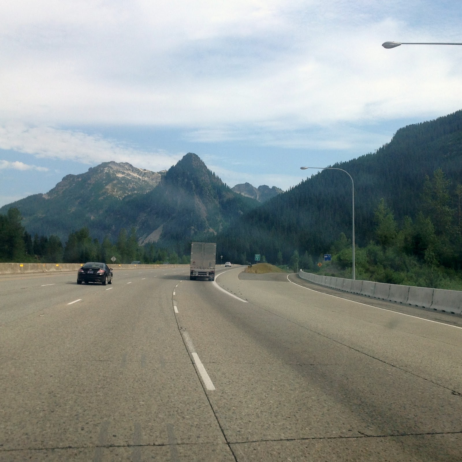
The scenery on the drive over from Twin Falls to Boise, Idaho,was not entirely as shown in this photograph: treeless, dry, rocky, and boring. Maybe only 50% of the drive was this view. There were sections especially where the interstate highway passed near the Snake River where the farms were green and the nearby towns looked normal with lots of trees and vegetation. Much of the land however, was what we think of when we think of the Wild West and both Kathy and I half expected to see a wagon train out in the distance.  We were after all following the Snake River and the Oregon Trail. Today the only structures rising above the ground were the numerous power poles, cell towers, and the occasional wind turbines.  In the 1860s the distant mountains and the gradual rise and fall of the land were all that changed the view.  It was of course, much prettier in the past without mankind's improvements or shall we say intrusions.  Not withstanding the ruggedness of the land, we very much enjoyed our three hour drive over to Idaho's capital city of Boise, population 214,237.

Unfortunately the interstate highway as it passed by Boise was crowded and under construction and we hated the 20 minutes or so that it took to get through the worst of the traffic and over to our campground located just west of Boise.  We are staying at the Boise Meridan KOA RV Resort, a large campground of some 224 spaces and as we were told, it was almost 100% occupied.  Fortunately the park was clean, and they had a nice recreational facility complete with a fitness workout room and an indoor pool.  The only problem with this park was that despite what they advertised, the only place that we could get WiFi service was in the Recreational Building and not out in our travel trailer.

The park also offered some other nice features such as this banjo/guitar group that played in the Recreational Building every Tuesday evenings and despite the surprisingly small turnout, their music was really quite good.  Besides listening to the music for awhile I also used their exercise room for a short period before I quickly realized that my month absence from our LA Fitness membership had taken its toil on my body.  I have quickly fallen out of shape.    

Kathy and I both agreed that we would wait until tomorrow before visiting downtown Boise and some of the area's tourist attractions. We finished the afternoon off after shopping for food and supplies, by just relaxing around our travel trailer.  One thing that we learned quickly after spending almost a month traveling across the country is that we need to occasionally relax and not try to be tourists every minute of the day.  Our attitude in this regard has paid off as we are still very much enjoying our Oregon Trail voyage.

Wednesday, July 24th:
We headed out towards downtown Boise by 8:30 am very much aware that we might not find anything open at this time of day. The morning temperature however, was still cool and we wanted to get an early start as temperatures in Boise this afternoon were expected to rise to 95 degrees. Kathy and I and especially the old "Fur-ball" Cabo, had no interest whatsoever in touring anywhere when it was really hot.  The first place we visited was Idaho's capital building in downtown Boise, and like most states their state government spent an enormous amount of money erecting this monument. That said, the building really was quite beautiful. While we were walking by the capital building we ran into a very nice women who stopped to admire Cabo.  She told us that she worked for the State's Treasury and that her job was to help Idaho citizens reclaim money that was being held by the government on their behalf. This was money that people were not aware that they were owed.  She said that the amount of money held in escrow by the government was in the millions of dollars.  We promised her that we would check with our Florida State government to see if we might be owned anything. Kind of a fun conversation. Our government at work.

We leaned from one of the local tourist brochures that there was a winery store downtown that was named the Snake River Winery.  I knew immediately that I must have a bottle of Snake River wine, so we found our way to the store and I purchased a bottle of Riesling that they claimed was made from grapes actually grown in Idaho. That is hard to believe but then Idaho is a state of many variations and wine growing might very well be one of them.    

At $15 per bottle this had better be good.  Kathy and I will advise you later if we recommend that that you get in touch with the Snake River Winery and purchase your own bottle.  After all, the Snake River and the Oregon Trail played a very important role in our country's history.  I am certain that we will toast to this fact as we enjoy the wine later in our trip.


Another well known tourist attraction in Boise is the Old Idaho Penitentiary and since we can proudly claim that we have never been in a penitentiary, we thought that now would be a good time for our first visit. Fortunately we did get to walk around the grounds and actually visit inside the Women's prison ward of the main prison, however for some completely irrational reason, small, absolutely harmless dogs are not allowed inside the main prison area.  Thanks to Cabo we saved the entrance fee of $4.00 each. So, we still have never been in a prison (other than a Women's Ward).

Incidentally the drive out to the old penitentiary was through one of Boise's older residential neighborhoods and it was really quite lovely and totally unexpected.  The homes were architecturally pleasing and the streets were tree lined and the yards of all of the older homes were green with well maintained lawns and landscaping. We found ourselves saying that it would be wonderful to live here if we were a little younger and had more years left in our lives to move around.

Immediately to the north side of Boise is a mountain range where we understand there is a ski resort. We did not want to drive too far out of the city but we thought that it would be interesting to drive north a few miles to see what changes we might find.  Not surprisingly we suppose, as we started up the mountain side, the city almost immediately disappeared and once again the scenery returned to dry, desert like conditions.  Beautiful in its own way, but an abrupt and total departure from the greenery of the city. Here and there on the tops of some of the hills above the city were million dollar homes with gated entrances and views that were spectacular. This photograph was taken no more than three or four miles from one of the beautifully landscaped neighborhoods of Boise.  The road we traveled was named Bogus Basin Road.  Never did figure out why?

We returned back to the city excited to visit one of Boise's many city parks most of which boarder the Boise River which winds its way through the city. The park we visited was named Ann Morrison Memorial Park and it was large, beautifully landscaped, and well used even on Wednesdays. The first thing that caught our eye was that along side and in the river were hundreds of Canada Geese.  We stopped the car and climbed out hoping to get a photo before we scarred them away.  Quite the opposite occurred.  The geese were so used to being feed by humans that they flocked around us. They lost interest however, as soon as no food was thrown their way and when Kathy put totally harmless Cabo on the ground, the geese literally ran away. This will be the only time in timid Cabo's life that he scared another living creature.

We could and did take many photos in this park but one of our favorites was this one of Kathy and Cabo in front of Boise's own old Faithful. We spent a good half hour or more driving through the park and we enjoyed it every bit as much as the many parks we enjoyed when we lived in Savannah.

Both Kathy and I very much enjoyed our brief visit to Boise, Idaho. We returned to our travel trailer by early afternoon, Mountain Time, ready to relax and plan out our long drive tomorrow up to Pendleton, Oregon.  It is here in Pendleton where Kathy plans on spending as much time as possible visiting the factory store at the Pendleton Woolen Mills. I told her that since I spent $15 on wine this morning, she could spend at least that amount on a Pendleton blanket or whatever.  She smiled, and slowly turned away.  I guess that meant she agreed.          


Monday, June 22, 2015

Chapter 15 - Idaho Falls to Twin Falls, Idaho

Sunday, June 21st:
Our drive today from Idaho Falls to Twin Falls, Idaho was approximately 165 miles and we were on the road a little over three hours. Almost the entire drive was on the interstates and the road was mostly straight with only gentle elevation changes. The speed limit was 80 mph so with our driving around 58 mph it is understandable that everyone passed us all morning long. That was fine with us. No stress. The scenery did not vary much from what we have become accustomed, although the farm plantings were now mostly potatoes and wheat and because of the dry climate huge sprinkler systems were in use almost everywhere.  We crossed the Snake River on numerous occasions and we were not surprised to see signs along the interstate informing us that the highway was generally following the Oregon Trail. According to Kathy the sign was very similar to one of the patches on her jacket. Kathy has been for many, many years a prolific collector of souvenir patches.

Another interesting sight that we saw today were huge banks of wind turbines. Each turbine must have been 200 to 300 feet tall and as a group they must have covered an area of at least 20 miles long by 5 miles wide. Unfortunately the only photograph that we took of these turbines was this one at a rest area and it hardly gives an impression of the immense quantity and size of the towers or the area that they covered.  Fortunately today for us it was not windy, but without wind most of the blades were not turning or they were turning very slowly. The sight of the turbines was interesting but at the same time they had a negative impact on the scenery. Hopefully the pressure from the global warming alarmists does not result that sometime in the future wind turbines will be covering all of our landscape.  And to think I was worried about road signs; at least they seem to be on the decline.

Our campsite for the next two nights is called the Twin Falls/Jerome KOA and unlike the previous two RV parks where we stayed, it was only around 60% occupied, which is good.  Our space was a pull-thru with a picnic table on a concrete pad with full hookups and a shade tree and if you are an avid RVer, this is an ideal situation.  Furthermore despite the fact that Kathy put up our antenna (force of habit), we are on cable here at this park which means that we get all the news channels like FOX and CNN that are talking around the clock about the murders in Charleston, SC.  Turn the damn TV off!

Our campground is about five miles north of the Snake River and the City of Twin Falls. Since we needed to make a few food purchases, some gas, and most importantly, a bottle of gin, we headed south to Twin Falls to find the stores.  To our remarkable surprise we discovered that the Snake River passes through the area in a deep canyon much like the Niagara River runs through a gorge below the falls.  We had to cross a long bridge over the canyon to get into the city.  We knew immediately that we had lots of sites to visit tomorrow.

            
Monday, June 22nd:
We drove away from our campground by 8:30 am very anxious to view the Snake River Canyon and all of the sights associated with this totally unexpected tourist attraction. We stopped at the Visitor's Center on the south side of the bridge where they had a viewing platform overlooking the gorge.  The photograph to the right does not, cannot, do the view justice. I know that we have said this before but the sights we keep encountering out here in the west, continue to amaze us.  Deep in the canyon on both sides of the Snake River are golf courses that I knew immediately we had to visit.

The Snake River Canyon is famous for obvious reasons, although the one that gave it a national recognition was back in 1974 when it was chosen by a daredevil named Evel Knievel as the site for his attempted jump over the gorge on his steam-powered rocket motorcycle.  For those of you too young to remember Evel Knievel, he became well-known for his long jumps on his motorcycle. His attempted jump over the gorge failed but thanks to a parachute he survived.  The canyon is also well known as a site where people are allowed to parachute off the bridge down into the gorge.  It is astonishing that the local government allows such an activity, but it occurs daily and we had the good fortune of watching a group of jumpers each jumping one at a time off the bridge. The photograph goes not really catch the activity very well since the jumper falls at least 100 feet before the chute opens and our viewing point was not very close, but if you look closely at the photo you will see a little white parachute half way through its decline. Not sure that even when I was younger I would ever have had the nerve to jump off a bridge. The four jumpers we watched were in the 20s.  Fear or marriage usually occurs shortly thereafter.

The drive down into the gorge was steep and winding and beautiful. We wanted a photograph looking back at the bridge from the bottom, and we also wanted a photo of the golf course, but what Kathy really wanted more than photographs was a copy of the golf course score card.  The course which was named Canyon Springs Golf Course, carries the remarkably low price for 18-holes of only $28 during the weekday, and according to our souvenir score card, from the white tees, the course plays 6,028 yards. And best of all, every hole has incredible views and oh was I so jealous.

Before we arrived at the golf course Kathy and I and Cabo (being carried) climbed up a steep rock hill that we thought would offer another great view of the golf course. It sure did!

The golf course appeared to be in great shape considering this very dry climate in southern Idaho.  Like everywhere else around here, the sprinkler systems seem to run night and day including on some of the fairways.  Par for the course?  The two golfers on the green got a kick out of my taking this photo. I told them that I wish I could join them.  I did not however, ask their golf scores.

This waterfall shows in the background of the previous photo of the golf course and it was really special and worthy of this larger photo of Kathy and Cabo in front of the respected, Perrine Falls.              


Up the Snake River a few miles above the bridge and the golf courses is the Shoshone Falls. According to the literature published by the local community, the falls is 212 feet tall which would make it 50 feet higher than Niagara Falls. The actual volume of water going over the falls has been somewhat reduced recently because they are expanding the power plant associated with the falls. Nevertheless, Shoshone Falls was every bit as impressive as Niagara Falls, rainbows and all, and you can take that as gospel as spoken from the mouths of former Niagara Falls residents.

It was early afternoon before we decided to return home to our campsite.  On the way back Kathy saw off in the distance what looked to me like a church tower, but she insisted it was not just a church, it was another Mormon Temple.  So we made our way over to the building and what we found was a huge and very expensive, and really quite beautiful Church of Jesus Christ of Latter-Day Saints. According to the plaque in the front of the church, it was built recently in 2007.  As a former general Contractor, my guess is that this building cost upwards of $10 million to build. Very impressive in this city of only 46,000.  We tried to enter the church but not surprisingly the front door was locked.

This afternoon Kathy and Cabo did the wash while I wrote this blog and made our reservations for tomorrow.  I also set up our grill so that Cabo and I could cook and eat our Idaho beef burgers tonight while Cabo's mother, well, she could prepare and eat her green stuff.  Tomorrow it is Boise or bust.